
IMAGES TAKEN NEAR TO
Victoria Street, NORTH SHIELDS, NE29 6TS
Introduction
This page details the photographs taken nearby to Victoria Street, NE29 6TS by members of the Geograph project.
The Geograph project started in 2005 with the aim of publishing, organising and preserving representative images for every square kilometre of Great Britain, Ireland and the Isle of Man.

There are currently over 7.5m images from over14,400 individuals and you can help contribute to the project by visiting https://www.geograph.org.uk
Image Map
Images are licensed for reuse under creativecommons.org/licenses/by-sa/2.0
Notes
- Clicking on the map will re-center to the selected point.
- The higher the marker number, the further away the image location is from the centre of the postcode.
Image Listing (47 Images Found)
Images are licensed for reuse under creativecommons.org/licenses/by-sa/2.0
Image
Details
Distance
1
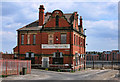
Wolsington House
The Wolsington House public house on the Tyne.
Image: © Peter McDermott
Taken: 21 May 2011
0.03 miles
2
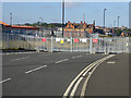
Road closed!
The road which runs north from Prince Consort Way to the waterfront at New Quay, North Shields is currently closed as massive redevelopment of the former dock area is under way.
Image: © Oliver Dixon
Taken: 30 Sep 2015
0.04 miles
4
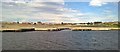
Once there were vibrant dockyards, now only peace
Image: © Chris Morgan
Taken: 12 Sep 2016
0.12 miles
5
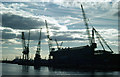
Shipyard at North Shields
This picture was taken from the Shields ferry which crosses the Tyne between North Shields and South Shields.
Image: © Stephen McKay
Taken: Unknown
0.13 miles
6
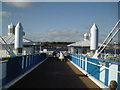
South Shields Ferry Landing
Rebuilt in 1999, this essential link has never looked more welcoming.
Image: © MSX
Taken: 12 Nov 2005
0.13 miles
7
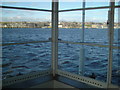
Tyne from Ferry Landing
Very high tide evident on this shot from within the Ferry Landing.
Image: © MSX
Taken: 12 Nov 2005
0.13 miles
8
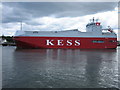
Neckar Highway heading seawards
Taken from North Shields ferry station. KESS is a wholly-owned subsidiary of "K" Line, a well-known carrier with all major car manufacturers around the North Sea and the Baltic Sea.
Image: © Brian Shaw
Taken: 30 Aug 2006
0.13 miles
9
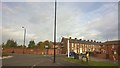
Howdon Road, from Dock Road, North Shields
Image: © Chris Morgan
Taken: 30 Oct 2016
0.13 miles
10
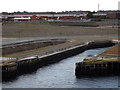
Bull Ring Docks
Disused [closed 1990s] graving docks on the River Tyne at North Shields.
www.portoftyne.co.uk
Image: © Colin Smith
Taken: 9 Sep 2012
0.13 miles