
IMAGES TAKEN NEAR TO
Seymour Street, NORTH SHIELDS, NE29 6SN
Introduction
This page details the photographs taken nearby to Seymour Street, NE29 6SN by members of the Geograph project.
The Geograph project started in 2005 with the aim of publishing, organising and preserving representative images for every square kilometre of Great Britain, Ireland and the Isle of Man.

There are currently over 7.5m images from over14,400 individuals and you can help contribute to the project by visiting https://www.geograph.org.uk
Image Map
Images are licensed for reuse under creativecommons.org/licenses/by-sa/2.0
Notes
- Clicking on the map will re-center to the selected point.
- The higher the marker number, the further away the image location is from the centre of the postcode.
Image Listing (40 Images Found)
Images are licensed for reuse under creativecommons.org/licenses/by-sa/2.0
Image
Details
Distance
3
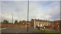
Howdon Road, from Dock Road, North Shields
Image: © Chris Morgan
Taken: 30 Oct 2016
0.13 miles
4
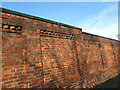
Brick Wall, Minton Lane
This fine brick wall, which stretches for more than 200 metres on the north side of Minton Lane, was once the southern boundary wall of the Minton Lane Gas Works. First appearing on the second edition of the Ordnance Survey Six-Inch map of the area in 1899, the gas works were, until dismantled in 2016, a vital part of the gas supply system, responsible for supplying gas to thousands of people across the country. More latterly, they were used to bolster the gas network’s supplies during colder weather, and at peak times in the early evenings. At the time of the publication of the 1899 map Minton Lane was known as Meadowell Lane. For a selection of detailed free to download walking routes in the area visit www.northtynesidewalks.co.uk
Image: © Geoff Holland
Taken: 30 Oct 2020
0.16 miles
5
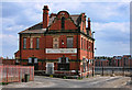
Wolsington House
The Wolsington House public house on the Tyne.
Image: © Peter McDermott
Taken: 21 May 2011
0.19 miles
6
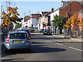
Borough Road, North Shields
The main way into town from the Tyne ferry.
Image: © Oliver Dixon
Taken: 30 Sep 2015
0.20 miles
7
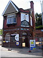
The Chain Locker Pub, North Shields
Sadly, only the shell of this once famous pub remains. There has been a pub on the site (opposite the entrance to the Ferry) since the early 19th century
Image: © Alan Fearon
Taken: 10 Jun 2005
0.20 miles
8
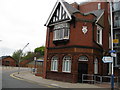
North Shields - The Crane House
The bus terminus for the foot passenger ferry can be seen on the left.
Image: © Alan Heardman
Taken: 13 May 2008
0.21 miles
9
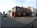
The Mariners Arms, North Shields
Viewed from Borough Road.
Image: © John Lucas
Taken: 15 Aug 2016
0.22 miles
10
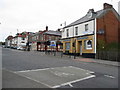
North Shields - The Ballarat
Junction of Borough Road and Saville Street.
Image: © Alan Heardman
Taken: 13 May 2008
0.22 miles