IMAGES TAKEN NEAR TO
Spencer Street, NORTH SHIELDS, NE29 6RF
Introduction
This page details the photographs taken nearby to Spencer Street, NE29 6RF by members of the Geograph project.
The Geograph project started in 2005 with the aim of publishing, organising and preserving representative images for every square kilometre of Great Britain, Ireland and the Isle of Man.

There are currently over 7.5m images from over14,400 individuals and you can help contribute to the project by visiting https://www.geograph.org.uk
Image Map (Loading...)


Getting Data...Please wait
Leaflet Map data © OpenStreetMap
Images are licensed for reuse under creativecommons.org/licenses/by-sa/2.0
Notes
- Clicking on the map will re-center to the selected point.
- The higher the marker number, the further away the image location is from the centre of the postcode.
Image Listing (118 Images Found)
Images are licensed for reuse under creativecommons.org/licenses/by-sa/2.0
Image
Details
Distance
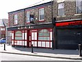
1
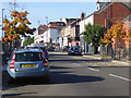
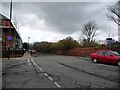
Borough Road, North Shields
The main way into town from the Tyne ferry.
Image: © Oliver Dixon
Taken: 30 Sep 2015
0.08 miles
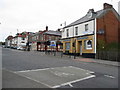
2
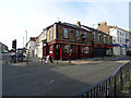
The Mariners Arms, North Shields
Viewed from Borough Road.
Image: © John Lucas
Taken: 15 Aug 2016
0.08 miles
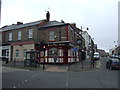
5
Mariners Arms, Saville Street West, North Shields
Image: © Andrew Curtis
Taken: 28 Jul 2013
0.09 miles
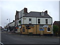
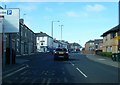
6
North Shields - The Ballarat
Junction of Borough Road and Saville Street.
Image: © Alan Heardman
Taken: 13 May 2008
0.09 miles
9
Junction of Borough Road and Railway Terrace
Image: © Christine Johnstone
Taken: 4 Mar 2010
0.10 miles
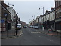
10
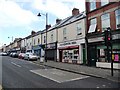
Shops on Saville Street West, North Shields
Image: © Christine Johnstone
Taken: 4 Mar 2010
0.10 miles