IMAGES TAKEN NEAR TO
St. Johns Terrace, NORTH SHIELDS, NE29 6HS
Introduction
This page details the photographs taken nearby to St. Johns Terrace, NE29 6HS by members of the Geograph project.
The Geograph project started in 2005 with the aim of publishing, organising and preserving representative images for every square kilometre of Great Britain, Ireland and the Isle of Man.

There are currently over 7.5m images from over14,400 individuals and you can help contribute to the project by visiting https://www.geograph.org.uk
Image Map
Images are licensed for reuse under creativecommons.org/licenses/by-sa/2.0
Notes
- Clicking on the map will re-center to the selected point.
- The higher the marker number, the further away the image location is from the centre of the postcode.
Image Listing (30 Images Found)
Images are licensed for reuse under creativecommons.org/licenses/by-sa/2.0
Image
Details
Distance
3
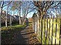
Cycle route on old railway
National Cycle Route 10, part of the Reiver's Cycle Route follows the line of the old Blyth and Tyne Railway and Seaton Burn Waggonway. Here it passes the back of Percy Crescent.
Image: © Oliver Dixon
Taken: 4 Dec 2013
0.12 miles
5
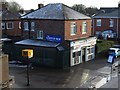
Sandwich Shop, Burdon Street, Percy Main
Photographed from Metro Station bridge over the road.
Image: © Andrew Curtis
Taken: 18 Jan 2018
0.13 miles
6
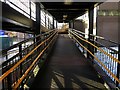
Walkway access to Percy Main Metro Station
Image: © Andrew Curtis
Taken: 18 Jan 2018
0.14 miles
7
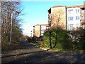
St John's Green
Blocks of flats on St John's Green. The road carries National Cycle Route 10, part of the Reiver's Cycle Route .
Image: © Oliver Dixon
Taken: 4 Dec 2013
0.14 miles
8
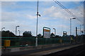
Percy Main Metro station
Photo 4 of a series of 9, showing the metro stations between Tynemouth and Chillingham rd (Newcastle)
Image: © hayley green
Taken: 31 Aug 2009
0.15 miles