
IMAGES TAKEN NEAR TO
Broomfield Avenue, WALLSEND, NE28 9AE
Introduction
This page details the photographs taken nearby to Broomfield Avenue, NE28 9AE by members of the Geograph project.
The Geograph project started in 2005 with the aim of publishing, organising and preserving representative images for every square kilometre of Great Britain, Ireland and the Isle of Man.

There are currently over 7.5m images from over14,400 individuals and you can help contribute to the project by visiting https://www.geograph.org.uk
Image Map
Images are licensed for reuse under creativecommons.org/licenses/by-sa/2.0
Notes
- Clicking on the map will re-center to the selected point.
- The higher the marker number, the further away the image location is from the centre of the postcode.
Image Listing (9 Images Found)
Images are licensed for reuse under creativecommons.org/licenses/by-sa/2.0
Image
Details
Distance
2
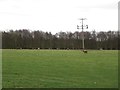
Grass field, Rising Sun Farm
A grass field being grazed by sheep close to the building of Rising Sun Farm.
Image: © Graham Robson
Taken: 19 Feb 2017
0.20 miles
3
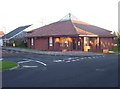
Good Shepherd Church at Battle Hill, Wallsend
A modern church and presbytery on Battle Hill estate. It's called The Church of The Good Shepherd. Founded in 1983, it is a joint Anglican, Methodist and URC Local Ecumenical Project, and has Sunday services at 9.30 and 6.00.
Image: © Weston Beggard
Taken: 13 Nov 2005
0.22 miles
4
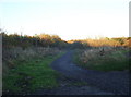
Footpath
Footpath leading to Rising Sun Farm on the very northern edge of Battle Hill estate.
Image: © Weston Beggard
Taken: 13 Nov 2005
0.22 miles
5
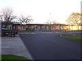
Battle Hill Primary School
A large, modern school on Battle Hill estate.
Image: © Weston Beggard
Taken: 13 Nov 2005
0.22 miles
6
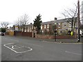
Rising Sun Cottages, Wallsend
A long terrace of houses on the southern boundary of Rising Sun Country Park.
Image: © Graham Robson
Taken: 19 Feb 2017
0.22 miles
7
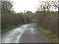
Road, Rising Sun Farm
This road provides access to the Rising Sun Farm which lies within the Rising Sun Country Park, a green oasis extending to some 162 hectares which boasts a nature reserve with ponds, woodlands and extensive grasslands, and Countryside Centre. The country park was once the site of one of the world's largest coal mines, the Rising Sun Colliery. The colliery started production in 1908, closed in 1969 and, at its height employed some 1,722 people. When the first Ordnance Survey Six-Inch map of the area was published in 1865, the Rising Sun Farm stood next to the Killingworth Waggonway. This road is also a public bridleway. For a selection of detailed free to download walking routes in the area visit www.northtynesidewalks.co.uk
Image: © Geoff Holland
Taken: 24 Nov 2020
0.23 miles
9
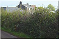
Rising Sun Farm
This is still a working farm but has a strong emphasis on stabling. There is also a shop selling farm produce.
Image: © Mac McCarron
Taken: 15 Oct 2007
0.24 miles