
IMAGES TAKEN NEAR TO
Holland Park, WALLSEND, NE28 8UJ
Introduction
This page details the photographs taken nearby to Holland Park, NE28 8UJ by members of the Geograph project.
The Geograph project started in 2005 with the aim of publishing, organising and preserving representative images for every square kilometre of Great Britain, Ireland and the Isle of Man.

There are currently over 7.5m images from over14,400 individuals and you can help contribute to the project by visiting https://www.geograph.org.uk
Image Map
Images are licensed for reuse under creativecommons.org/licenses/by-sa/2.0
Notes
- Clicking on the map will re-center to the selected point.
- The higher the marker number, the further away the image location is from the centre of the postcode.
Image Listing (21 Images Found)
Images are licensed for reuse under creativecommons.org/licenses/by-sa/2.0
Image
Details
Distance
1
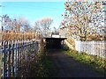
Cycleway under the East Coast Main Line
The cycleway which links the Coast Road with the Coxlodge Waggonway.
Image: © Oliver Dixon
Taken: 4 Dec 2013
0.09 miles
2
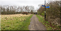
Bridleway heading towards bridge carrying railway
The bridleway is seen heading towards a low embankment carrying the East Coast Main line through the eastern side of Newcastle; it's just visible between the trees on the left and centre skyline.
It's possible that the route is part of the Coxlodge Waggonway; there's an interpretation board close to the camera position which obviously describes that old route. The interpretation board however was so covered with graffiti that interpretation was impossible!
Image: © Trevor Littlewood
Taken: 16 Mar 2016
0.10 miles
3
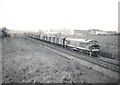
'Peak' Type 4 heads north with a fast goods train
Image: © Roger Cornfoot
Taken: Unknown
0.15 miles
5
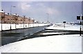
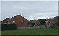
The 'Original' Coast Road
Taken near the transact lines of 2 grid squares. This view was taken from the corner of West St as it joined the A1058. The flats are now demolished and surprisingly nothing has been built in its place - yet!!
Image: © Christine Westerback
Taken: Unknown
0.18 miles
6
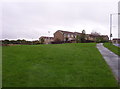
Wiltshire Drive
Modern housing on Wiltshire Drive
Image: © Weston Beggard
Taken: 22 Oct 2005
0.18 miles
7
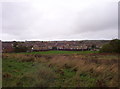
Wiltshire Drive
Housing around Wiltshire Drive. The land in the foreground is the sad remains of a BMX bike track, where the photographer spent much of his early teenage years.
Image: © Weston Beggard
Taken: 22 Oct 2005
0.18 miles
8
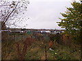
Allotment gardens
Allotment gardens to the north of the A1058 Coast Road
Image: © Weston Beggard
Taken: 22 Oct 2005
0.18 miles
9
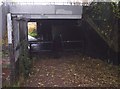
Railway bridge
Footpath under the main East-coast railway line, with a curious barrier that seems designed to prevent anyone overweight from passing through.....
Image: © Weston Beggard
Taken: 22 Oct 2005
0.18 miles
10
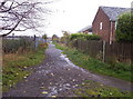
Footpath
Footpath between housing on the right and allotment gardens on the left
Image: © Weston Beggard
Taken: 22 Oct 2005
0.18 miles