
IMAGES TAKEN NEAR TO
High View, WALLSEND, NE28 8SR
Introduction
This page details the photographs taken nearby to High View, NE28 8SR by members of the Geograph project.
The Geograph project started in 2005 with the aim of publishing, organising and preserving representative images for every square kilometre of Great Britain, Ireland and the Isle of Man.

There are currently over 7.5m images from over14,400 individuals and you can help contribute to the project by visiting https://www.geograph.org.uk
Image Map
Images are licensed for reuse under creativecommons.org/licenses/by-sa/2.0
Notes
- Clicking on the map will re-center to the selected point.
- The higher the marker number, the further away the image location is from the centre of the postcode.
Image Listing (39 Images Found)
Images are licensed for reuse under creativecommons.org/licenses/by-sa/2.0
Image
Details
Distance
2
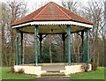
Bandstand
Richardson Dees Park, Wallsend
Image: © Christine Westerback
Taken: 4 Mar 2011
0.16 miles
4
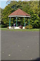
Bandstand, Richardson Dees Park, Wallsend
Image: © Mac McCarron
Taken: 21 Oct 2007
0.17 miles
5
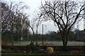
Tennis Courts
Richardson Dees Park, Wallsend
Image: © Christine Westerback
Taken: 4 Mar 2011
0.17 miles
6
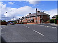
Junction of Prince Road and Queen's Crescent
Local authority housing of the 1920s.
Image: © Mac McCarron
Taken: 20 Jun 2008
0.18 miles
7
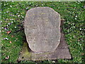
Carved Stone
“A garden is a loving thing, God Wot’
Fringed Pool;
Rose Plot, Fern Grot;
The veriest school of peace, and yet the fool,
Contends that God is not,
Not God in gardens when the eve is cool.
Nay! But I have a sign,
‘Tis sure, God walks in mine.”
These words were written about the grounds of Wallsend Hall
Image: © Christine Westerback
Taken: 4 Mar 2011
0.19 miles
8
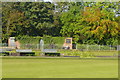
"Veteran's Hut" and Kiosk
The veterans have now moved to the pavilion.
Image: © Mac McCarron
Taken: 21 Oct 2007
0.19 miles
9
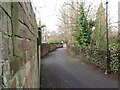
Lily Bank, Wallsend
When the first Ordnance Survey Six-Inch map of the area was published in 1865, Lily Bank at this point followed much the line as it does today. At the bottom of the bank, where the road now joins Kings Road South, the route then turned north linking the various properties and farms in the area of The Green with the settlements at Bridge Row, Willington Low Row and Rising Sun. For a selection of detailed free to download walking routes in the area visit www.northtynesidewalks.co.uk
Image: © Geoff Holland
Taken: 9 Mar 2021
0.19 miles
10
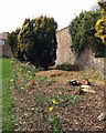
Border
The border along here also had several felled bushes/trees
Image: © Christine Westerback
Taken: 16 Mar 2012
0.20 miles