IMAGES TAKEN NEAR TO
Station Road North, WALLSEND, NE28 8AE
Introduction
This page details the photographs taken nearby to Station Road North, NE28 8AE by members of the Geograph project.
The Geograph project started in 2005 with the aim of publishing, organising and preserving representative images for every square kilometre of Great Britain, Ireland and the Isle of Man.

There are currently over 7.5m images from over14,400 individuals and you can help contribute to the project by visiting https://www.geograph.org.uk
Image Map
Images are licensed for reuse under creativecommons.org/licenses/by-sa/2.0
Notes
- Clicking on the map will re-center to the selected point.
- The higher the marker number, the further away the image location is from the centre of the postcode.
Image Listing (8 Images Found)
Images are licensed for reuse under creativecommons.org/licenses/by-sa/2.0
Image
Details
Distance
1
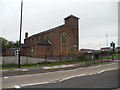
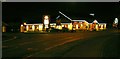
The R.C. Church of St Bernadette, Station Road, Wallsend
Image: © Bill Henderson
Taken: 11 Jun 2012
0.01 miles
3
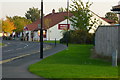
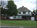
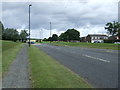
Powder Monkey
Not named after boys who carried powder in the Royal Navy but after boys who carried out a similar function in the coal mines (allegedly). Forty or fifty years ago it was used as the name of a small area to the west where the allotments are located.
Image: © Mac McCarron
Taken: 20 Oct 2007
0.04 miles
7
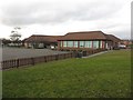
Wallsend Jubilee Primary School
A primary school on land close to Rising Sun Country Park.
Image: © Graham Robson
Taken: 19 Feb 2017
0.23 miles