
IMAGES TAKEN NEAR TO
Shakespeare Street, WALLSEND, NE28 7DG
Introduction
This page details the photographs taken nearby to Shakespeare Street, NE28 7DG by members of the Geograph project.
The Geograph project started in 2005 with the aim of publishing, organising and preserving representative images for every square kilometre of Great Britain, Ireland and the Isle of Man.

There are currently over 7.5m images from over14,400 individuals and you can help contribute to the project by visiting https://www.geograph.org.uk
Image Map
Images are licensed for reuse under creativecommons.org/licenses/by-sa/2.0
Notes
- Clicking on the map will re-center to the selected point.
- The higher the marker number, the further away the image location is from the centre of the postcode.
Image Listing (23 Images Found)
Images are licensed for reuse under creativecommons.org/licenses/by-sa/2.0
Image
Details
Distance
1
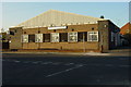
Archer Street Social Club
Formerly the British Legion Club
Image: © Mac McCarron
Taken: 20 Oct 2007
0.04 miles
2
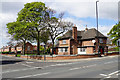
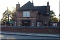
The Rosehill Tavern
A large pub on a corner plot.
Image: © Bill Boaden
Taken: 20 Apr 2017
0.09 miles
5
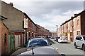
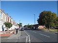
Stanley Street
A street of terraced houses where parking is tight.
Image: © Bill Boaden
Taken: 20 Apr 2017
0.10 miles
7
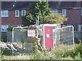
Protected ruin, Churchill Street
The remains of a small brick building which is sort of semi-preserved on a patch of land which is about to be developed.
Image: © Richard Webb
Taken: 1 Oct 2015
0.11 miles
8
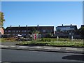
Development site, Churchill Street
A hoarding advertises availability in Dec. 2015 but little sign of building.
Image: © Richard Webb
Taken: 1 Oct 2015
0.12 miles
9
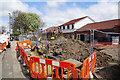
Construction site on Churchill Street
This will be a mixed commercial and residential development.
Image: © Bill Boaden
Taken: 20 Apr 2017
0.12 miles
10
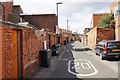
Back passage in Howdon
This passage runs between the rows on Stanley Street and Tynemouth Road, and it appears to have been made up to adopted highway standards.
Image: © Bill Boaden
Taken: 20 Apr 2017
0.12 miles