
IMAGES TAKEN NEAR TO
Bewicke Street, WALLSEND, NE28 6SR
Introduction
This page details the photographs taken nearby to Bewicke Street, NE28 6SR by members of the Geograph project.
The Geograph project started in 2005 with the aim of publishing, organising and preserving representative images for every square kilometre of Great Britain, Ireland and the Isle of Man.

There are currently over 7.5m images from over14,400 individuals and you can help contribute to the project by visiting https://www.geograph.org.uk
Image Map
Images are licensed for reuse under creativecommons.org/licenses/by-sa/2.0
Notes
- Clicking on the map will re-center to the selected point.
- The higher the marker number, the further away the image location is from the centre of the postcode.
Image Listing (56 Images Found)
Images are licensed for reuse under creativecommons.org/licenses/by-sa/2.0
Image
Details
Distance
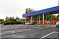
2
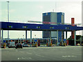
Tyne Tunnel Toll Plaza (Northbound)
The Tyne Tunnel is the furthest downstream fixed crossing of the River Tyne and is part of the A19.
The original project consisted of a set of foot and cycle tunnels, opened in 1951, and a single carriageway road tunnel, which opened in 1967. The tunnel became a severe bottleneck during the 1980s and 1990s, and, in 2004, it was decided to build a second parallel tunnel. Construction started in 2008 and opened in early 2011. Traffic started using both tunnels and hence the route became dual carriageway in late 2011 (https://www.sabre-roads.org.uk/wiki/index.php?title=Tyne_Tunnel SABRE).
Image: © David Dixon
Taken: 29 Apr 2019
0.05 miles
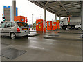
4
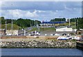
Toll Booths
On the north end of the Tyne Tunnel.
Tunnel somewhere down below!
Image: © Russel Wills
Taken: 7 Aug 2014
0.06 miles
5
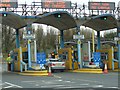
Big Brother is Watching You!
There are a large number of cameras around the toll booths. One more little picture shouldn't make a difference.
Taken whilst heading southwards (even though we are facing north) waiting to locate some change as there is no advance warning of the Toll.
Image: © Ian Paterson
Taken: 2 Nov 2008
0.07 miles
7
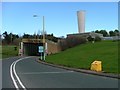
Tyne Tunnel North Entrance
Before anyone comments this was taken from a left hand drive vehicle driven by my wife.
Image: © Mick Garratt
Taken: 9 Apr 2006
0.09 miles
8
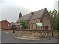
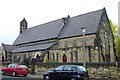
The Former St Paul's Church, Willington Quay
This building is now used as a Community Centre.
Image: © Bill Henderson
Taken: 10 Jun 2012
0.09 miles
10
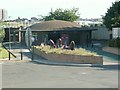
Cyclist and Pedestrian Tunnel Entrance
The country's first purpose-built cyclist and pedestrian tunnel, connecting Howdon on the North side to Jarrow on the South. Opened in 1951, it is 275m (900ft) in length. When built, the single flight escalators were the longest "WOODEN ESCALATORS" in the world (possibly still are today) with 306 steps, 61.5m (200ft) in length with a vertical drop of 26.15m (85ft). The series of fish heads and tails which appear to be jumping out of the ground in front of the entrance is called "The Ones That Got Away" representing the revitalisation of the River Tyne. Cast in Polymer and painted in two-tone iridescent paint which changes colour as you move past them, simulating the effect of fish scales.
Image: © Ken Brown
Taken: 1 Jul 2005
0.11 miles