
IMAGES TAKEN NEAR TO
Bewicke Road, WALLSEND, NE28 6LY
Introduction
This page details the photographs taken nearby to Bewicke Road, NE28 6LY by members of the Geograph project.
The Geograph project started in 2005 with the aim of publishing, organising and preserving representative images for every square kilometre of Great Britain, Ireland and the Isle of Man.

There are currently over 7.5m images from over14,400 individuals and you can help contribute to the project by visiting https://www.geograph.org.uk
Image Map
Images are licensed for reuse under creativecommons.org/licenses/by-sa/2.0
Notes
- Clicking on the map will re-center to the selected point.
- The higher the marker number, the further away the image location is from the centre of the postcode.
Image Listing (26 Images Found)
Images are licensed for reuse under creativecommons.org/licenses/by-sa/2.0
Image
Details
Distance
1
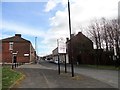
The centre of Willington Quay
Looking east along Bewicke Road, the main street through the Wallsend suburb of Willington Quay.
Image: © Robert Graham
Taken: 9 Mar 2020
0.02 miles
3
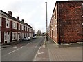
Looking west along Bewucke Road
The main street in Willington Quay. These terraces are late Victorian. Most of Willington Quay is a late 19th, early 20th century industrial suburb.
Image: © Robert Graham
Taken: 9 Mar 2020
0.04 miles
4
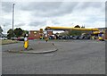
Jet Service Station, Willington Quay
Cars can be seen queuing for fuel in 'panic' mode, during the petrol 'crisis' of September 2021.
Image: © Roger Cornfoot
Taken: 25 Sep 2021
0.05 miles
5
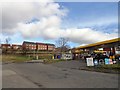
Garage on Bewicke Road, Willington Quay
Willington Quay is the easternmost suburb of Wallsend. Bewicke Road runs through its centre. Of interest here is the old stone wall behind the garage, which once ran along the side of the River Line railway. This was a loop line of the North Shields to Newcastle Railway, opened in 1879 and closed in 1978.
Image: © Robert Graham
Taken: 9 Mar 2020
0.07 miles
6
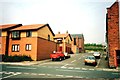
Station Road, Willington Quay
Junction of Station Road and Bewicke Road. Taken in 1991. Area of greenery visible in distance is now built over.
Image: © Clint Mann
Taken: Unknown
0.08 miles
8
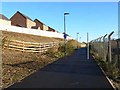
Cycle route behind Hadrian Road
National Cycle Network route 72 (eastern end of Hadrian's Cycleway). A new housing estate has been recently built on the uphill side.
Image: © Oliver Dixon
Taken: 4 Dec 2013
0.12 miles
10
Potter Street, Willington Quay
This street on the eastern side of Wallsend used to be lined with Victorian terraces, which are long gone. The big fabrication shed on the right was originally part of Cleland Shipbuilding Company, until it closed in 1984. For the next 20 or so years, it was an offshore fabrication yard run laterally by Amec Offshore. It is now owned by a waste recycling company.
Image: © Robert Graham
Taken: 9 Mar 2020
0.12 miles