
IMAGES TAKEN NEAR TO
Station Road, WALLSEND, NE28 6HD
Introduction
This page details the photographs taken nearby to Station Road, NE28 6HD by members of the Geograph project.
The Geograph project started in 2005 with the aim of publishing, organising and preserving representative images for every square kilometre of Great Britain, Ireland and the Isle of Man.

There are currently over 7.5m images from over14,400 individuals and you can help contribute to the project by visiting https://www.geograph.org.uk
Image Map
Images are licensed for reuse under creativecommons.org/licenses/by-sa/2.0
Notes
- Clicking on the map will re-center to the selected point.
- The higher the marker number, the further away the image location is from the centre of the postcode.
Image Listing (158 Images Found)
Images are licensed for reuse under creativecommons.org/licenses/by-sa/2.0
Image
Details
Distance
2

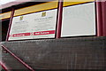
Historic Shop Shutter, Station Road, Wallsend
This historic shop shutter is part of a project to brighten up Wallsend town centre, and to spark fresh interest in local heritage. There are a total of 18 shop shutters decorated with images from Wallsend’s rich history with scenes ranging from ship launches and trams to workers leaving Swan Hunter’s shipyard, a former cinema on Station Road, and the narrow streets of old Wallsend. This one shows the workforce from Swan Hunter’s Shipyard making their way home after a day’s work. The project forms part of the North Tyneside Council’s 'Ambition for Wallsend' initiative.
Image: © Geoff Holland
Taken: 22 Jul 2025
0.01 miles
3
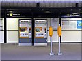
Wallsend Metro Station No Smoking sign
Several of the signs in the station are in Latin - you either love them or hate them.
Image: © Mac McCarron
Taken: 30 Sep 2007
0.03 miles
4
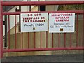
Latin spoken here
A number of the signs around Wallsend Metro Station are in Latin, to celebrate its vicinity to the western end of Hadrian's Wall.
Image: © Oliver Dixon
Taken: 18 Nov 2008
0.03 miles
6
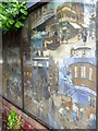
'Historic' gas substation, Buddle Street (detail)
Mural on south wall of gas substation Image showing the history of this part of Wallsend from Roman times to the Industrial Revolution.
Image: © Andrew Curtis
Taken: 28 Jul 2013
0.04 miles
7
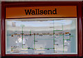
Hadrian's Wall map, Wallsend Metro station
The H MVRVS schematic imitates the style of the those used by the M METRO. The "stations" marked are Maia, Concauata, Aballava, Uxelodunum, Camboglanna, Banna, Magna, Aesica, Vindolanda, Verovicium, Brocolitia, Cilumum, Onnum, Vindobala, Condercum, Pons Aelius and Segedunum. Artwork by Michael Pinsky.
Image: © Keith Edkins
Taken: 7 Sep 2004
0.04 miles
10
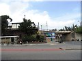
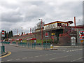
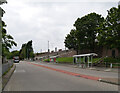
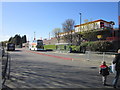
Bus and Metro Stations at Wallsend
The two public transport stations in Wallsend are placed next to each other, to the great convenience of passengers. As can be seen, the Metro platform is a bit of a climb up, although there is a long ramp further along.
Image: © Robert Graham
Taken: 24 Jul 2013
0.04 miles