
IMAGES TAKEN NEAR TO
Neptune Road, WALLSEND, NE28 6DD
Introduction
This page details the photographs taken nearby to Neptune Road, NE28 6DD by members of the Geograph project.
The Geograph project started in 2005 with the aim of publishing, organising and preserving representative images for every square kilometre of Great Britain, Ireland and the Isle of Man.

There are currently over 7.5m images from over14,400 individuals and you can help contribute to the project by visiting https://www.geograph.org.uk
Image Map
Images are licensed for reuse under creativecommons.org/licenses/by-sa/2.0
Notes
- Clicking on the map will re-center to the selected point.
- The higher the marker number, the further away the image location is from the centre of the postcode.
Image Listing (95 Images Found)
Images are licensed for reuse under creativecommons.org/licenses/by-sa/2.0
Image
Details
Distance


3
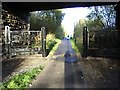
Gateway on Hadrian's Way at Low Walker
Hadrian's Way is the name given to the traffic-free route along the north bank of the Tyne between the western and eastern boundaries of the City of Newcastle. At its eastern end, the Way follows the course of a disused railway. The Way is followed by both Hadrian's Wall National Trail http://www.nationaltrail.co.uk/hadrianswall/ and by route 72 of the National Cycle Network (Hadrian's Cycleway
http://www.cycle-routes.org/HADRIANSCYCLEWAY/and the Tynemouth branch of the C2C Cycle Route).
Here where the Way passes under a side street, an elaborate gateway has been erected across the path.
http://www.c2c-guide.co.uk/).
between the western and eastern boundaries of the City of Newcastle. At its eastern end, the Way
follows the course of a disused railway. The Way is followed by both Hadrian's Wall National
Trail
http://www.nationaltrail.co.uk/hadrianswall/ and by route 72 of the National Cycle Network
(Hadrian's Cycleway
http://www.cycle-routes.org/HADRIANSCYCLEWAY/and the Tynemouth branch of the C2C Cycle Route
http://www.c2c-guide.co.uk/).
between the western and eastern boundaries of the City of Newcastle. At its eastern end, the Way
follows the course of a disused railway. The Way is followed by both Hadrian's Wall National
Trail
http://www.nationaltrail.co.uk/hadrianswall/ and by route 72 of the National Cycle Network
(Hadrian's Cycleway
http://www.cycle-routes.org/HADRIANSCYCLEWAY/and the Tynemouth branch of the C2C Cycle Route
http://www.c2c-guide.co.uk/).
Image: © Oliver Dixon
Taken: 18 Nov 2008
0.04 miles
4
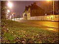
Neptune Road
Leading to Wallsend and the Segedunum Roman ruins.
Image: © Stephen Sweeney
Taken: 7 Jan 2009
0.04 miles
6
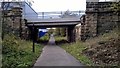
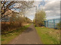
Benton Way goes over the old Riverside Railway tracks
Now part of Hadrian's Way path
Image: © Chris Morgan
Taken: 30 Oct 2016
0.05 miles
7
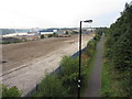
Hadrian's wall path and site of Neptune Shipyard
Image: © Gareth James
Taken: 5 Sep 2013
0.05 miles
8
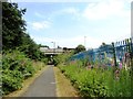
Bridge across the old railway at Wallsend
The bridge carries Benton Way, a road which once led to the Mid Tyne Ferry landing stage. This was used by hundreds of shipyard workers and others in the past, but has long since closed. View is from the west, on the old railway walk which is now the Hadrian's Wall Path.
Image: © Robert Graham
Taken: 24 Jul 2013
0.06 miles
9

Hadrian's Wall Path
Following the route of an old railway and here going under Benton Way. It is also part of National Cycle Route 72.
Image: © Bill Boaden
Taken: 20 Apr 2017
0.06 miles
10

Redevelopment of site of former Neptune Shipyard, Benton Way
A very important archaeological discovery was made close to the left hand boundary
Image
It is likely that the photo here Image is looking towards this site from the opposite direction.
Image: © Andrew Curtis
Taken: 28 Jul 2013
0.06 miles