
IMAGES TAKEN NEAR TO
Tynemouth Road, WALLSEND, NE28 0BA
Introduction
This page details the photographs taken nearby to Tynemouth Road, NE28 0BA by members of the Geograph project.
The Geograph project started in 2005 with the aim of publishing, organising and preserving representative images for every square kilometre of Great Britain, Ireland and the Isle of Man.

There are currently over 7.5m images from over14,400 individuals and you can help contribute to the project by visiting https://www.geograph.org.uk
Image Map
Images are licensed for reuse under creativecommons.org/licenses/by-sa/2.0
Notes
- Clicking on the map will re-center to the selected point.
- The higher the marker number, the further away the image location is from the centre of the postcode.
Image Listing (26 Images Found)
Images are licensed for reuse under creativecommons.org/licenses/by-sa/2.0
Image
Details
Distance
6
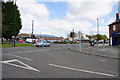
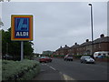
Tynemouth Road, Howdon
Seen at the junction with Howdon Lane. On the opposite side is an Aldi and a Spar shop.
Image: © Bill Boaden
Taken: 20 Apr 2017
0.07 miles
7
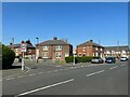
Junction of Hazelwood Terrace and Howdon Lane
Image: © Adrian Taylor
Taken: 29 Apr 2022
0.10 miles
8
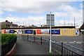
New housing development in Howdon
This is on the site of the former St Mark's United Reformed Church, and the development is being called St Mark's Place.
Image: © Bill Boaden
Taken: 20 Apr 2017
0.10 miles
9
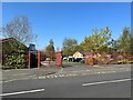
Howdon Children's Centre entrance gates
The Children’s Centre provides help and advice on child and family health, parenting, training, managing money and employment. It also provides free activities for the whole family, aimed at giving families opportunities to have fun together and to develop skills for school, work and life.
Image: © Adrian Taylor
Taken: 29 Apr 2022
0.13 miles
10
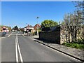
Howdon Lane
Howdon Lane near Howdon Station and the level crossing over the Tyne and Wear Metro.
The stone wall on the right was formerly that of the railway goods yard. Facing the road on the nearest corner of the stone wall is an Ordnance Survey cut benchmark (photograph Image).
Image: © Adrian Taylor
Taken: 29 Apr 2022
0.13 miles