IMAGES TAKEN NEAR TO
The Links, WHITLEY BAY, NE26 4RR
Introduction
This page details the photographs taken nearby to The Links, NE26 4RR by members of the Geograph project.
The Geograph project started in 2005 with the aim of publishing, organising and preserving representative images for every square kilometre of Great Britain, Ireland and the Isle of Man.

There are currently over 7.5m images from over14,400 individuals and you can help contribute to the project by visiting https://www.geograph.org.uk
Image Map
Images are licensed for reuse under creativecommons.org/licenses/by-sa/2.0
Notes
- Clicking on the map will re-center to the selected point.
- The higher the marker number, the further away the image location is from the centre of the postcode.
Image Listing (36 Images Found)
Images are licensed for reuse under creativecommons.org/licenses/by-sa/2.0
Image
Details
Distance
1
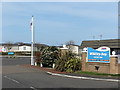
Whitley Bay Holiday Park Entrance, Whitley Bay
This holiday park, which has had a chequered history, is now operated by Parkdean Resorts and enjoys an enviable position on the northern boundary of the town. When the first Ordnance Survey Six-Inch map of the area was published in 1865 the land on which the park now sits was farm land, but by the time the 1898 map was published the land was occupied by an 880 yard firing range with 'Butts, Targets & Flagstaffs'. In both the 1914-18 & 1939-45 conflicts the land was used as an Army Camp where, in time, some prisoners of war were kept. For a selection of detailed free to download walking routes in the area visit www.northtynesidewalks.co.uk
Image: © Geoff Holland
Taken: 7 Apr 2020
0.01 miles
2
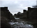
Dismantled Bridge
Dismantled bridge over long disused railway line
Image: © Christine Westerback
Taken: 31 Dec 2005
0.05 miles
3
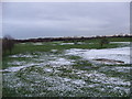
Whitley Bay Golf Club
View from the North. No players out this day!
Image: © Christine Westerback
Taken: 31 Dec 2005
0.05 miles
5
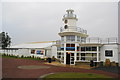
The clubhouse at Whitley Bay Holiday Park
The lighthouse on St Mary's Island is visible from the holiday park, so it is not unreasonable to copy it.
Image: © Bill Boaden
Taken: 16 Sep 2011
0.08 miles
7
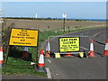
Temporary Signage, Trinity Road near St. Mary's Island, Whitley Bay
The message on these signs which were erected at the height of the coronavirus restrictions, made under The Health Protection (Coronavirus, Restrictions) (England) Regulations 2020, is loud and clear. Whilst access along Trinity Road, to St. Mary's Island, was temporarily restricted for vehicles this did not prevent those travelling on foot or by pedal cycle. Further nearby measures to encourage what was referred to as 'social-distancing' can be seen at https://www.geograph.org.uk/photo/6437310. For a selection of detailed free to download walking routes in the area visit www.northtynesidewalks.co.uk
Image: © Geoff Holland
Taken: 7 Apr 2020
0.10 miles
8

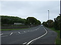
Towards Whitley Bay Holiday Park
Looking along the east facing side of the holiday park from a road to St. Mary's Island.
Image: © DS Pugh
Taken: 15 Aug 2025
0.10 miles