
IMAGES TAKEN NEAR TO
Alnwick Avenue, WHITLEY BAY, NE26 3PT
Introduction
This page details the photographs taken nearby to Alnwick Avenue, NE26 3PT by members of the Geograph project.
The Geograph project started in 2005 with the aim of publishing, organising and preserving representative images for every square kilometre of Great Britain, Ireland and the Isle of Man.

There are currently over 7.5m images from over14,400 individuals and you can help contribute to the project by visiting https://www.geograph.org.uk
Image Map
Images are licensed for reuse under creativecommons.org/licenses/by-sa/2.0
Notes
- Clicking on the map will re-center to the selected point.
- The higher the marker number, the further away the image location is from the centre of the postcode.
Image Listing (49 Images Found)
Images are licensed for reuse under creativecommons.org/licenses/by-sa/2.0
Image
Details
Distance
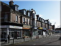
2

'Fleming Memorial Lodge', Village Court, Whitley Bay
The Northumberland Village Homes, Whitley Bay were built in the late 19th century for destitute and homeless girls. Run on a "cottage homes" basis, each home housed groups of up to 16 girls, led by a "house mother". The girls worked hard and were given more tasks and responsibilities as they got older. Being certified as an industrial school the homes received girls placed under detention by magistrates as well a girls who came on a voluntary basis or from workhouses. The first block of 2 homes were opened on the 11th of May 1880 whilst a further 4 blocks, each of 2 homes, were built over the next 10 years, housing about 130 girls. A school room was added in 1884 and in 1891, funded by a legacy of £2,500 from a John Fleming, a gardener's lodge and laundry building were added. During the First World War daughters of soldiers and sailors away in service were able to stay at the homes. However, reflecting changes in social policy, the homes became an Approved School in 1933 and finally closed in March 1985. They were then converted for private residential use with new houses on the other side of Village Court being built in a similar style to the Homes. A closer examination of this photograph will reveal on the black beam above the four paned window the words, "Fleming Memorial Lodge HD 1891".
Image: © Geoff Holland
Taken: 25 Mar 2026
0.10 miles
5
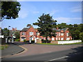
South end of Village Court, Monkseaton
Private road off Norham Road.
Image: © Richard Vince
Taken: 22 Jun 2019
0.14 miles
6
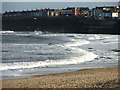
View South from Rendezvous Cafe
Houses overlooking Whitley Sands which are in next square
Image: © Christine Westerback
Taken: 1 Mar 2008
0.15 miles
8
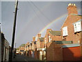
Back Lane behind Beach Avenue
This is a picture of a rainbow taken from the back lane behind Beach Avenue, Whitley Bay
Image: © walter young
Taken: Unknown
0.15 miles
9
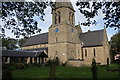
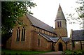
St Paul's Church, Whitley Bay
The church is situated in the commercial centre of Whitley Bay which is a little inland.
Image: © Bill Boaden
Taken: 17 Sep 2011
0.16 miles
10
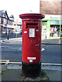
Post Box, Coquet Avenue, Whitley Bay
This box dates from the reign of Elizabeth II. The Royal Mail is a key partner in the Government's Coronavirus testing programme and collect completed testing kits from over 35,000 specially selected post boxes of which this is one (see stickers attached to the box). For a selection of detailed free to download walking routes in the area visit www.northtynesidewalks.co.uk
Image: © Geoff Holland
Taken: 18 Jan 2021
0.16 miles