
IMAGES TAKEN NEAR TO
Park Gardens, WHITLEY BAY, NE26 2TX
Introduction
This page details the photographs taken nearby to Park Gardens, NE26 2TX by members of the Geograph project.
The Geograph project started in 2005 with the aim of publishing, organising and preserving representative images for every square kilometre of Great Britain, Ireland and the Isle of Man.

There are currently over 7.5m images from over14,400 individuals and you can help contribute to the project by visiting https://www.geograph.org.uk
Image Map
Images are licensed for reuse under creativecommons.org/licenses/by-sa/2.0
Notes
- Clicking on the map will re-center to the selected point.
- The higher the marker number, the further away the image location is from the centre of the postcode.
Image Listing (52 Images Found)
Images are licensed for reuse under creativecommons.org/licenses/by-sa/2.0
Image
Details
Distance
2
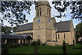
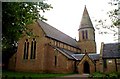
St Paul's Church, Whitley Bay
The church is situated in the commercial centre of Whitley Bay which is a little inland.
Image: © Bill Boaden
Taken: 17 Sep 2011
0.04 miles
3
St Paul's Church, Whitley Bay
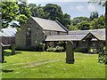
St Paul's Church is the parish church of Whitley Bay. The church was founded in 1864. The church's official title is St Paul's Church, Cullercoats but as it is in the town of Whitley Bay it is more commonly known as the former http://en.wikipedia.org/wiki/St_Paul's_Church,_Whitley_Bay .
The church, designed by Anthony Salvin for the Duke of Northumberland, has been designated by English Heritage as a Grade II listed building (English Heritage Building ID: 303430 http://www.britishlistedbuildings.co.uk/en-303430-church-of-st-paul- British Listed Buildings).
Image: © David Dixon
Taken: 20 Jun 2014
0.05 miles
4
The Parish Church of St Paul, Whitley Bay
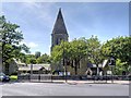
St Paul's Church is the parish church of Whitley Bay. The church was founded in 1864. The church's official title is St Paul's Church, Cullercoats but as it is in the town of Whitley Bay it is more commonly known as the former http://en.wikipedia.org/wiki/St_Paul's_Church,_Whitley_Bay .
The church, designed by Anthony Salvin for the Duke of Northumberland, has been designated by English Heritage as a Grade II listed building (English Heritage Building ID: 303430 http://www.britishlistedbuildings.co.uk/en-303430-church-of-st-paul- British Listed Buildings).
Image: © David Dixon
Taken: 20 Jun 2014
0.06 miles

7
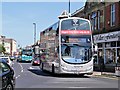
Whitley Road
Go North East Volvo B9TL/Wright Gemini 2 (6111, NL63 XBV) at Whitley Bay, on the Cobalt Clipper 309 service to Newcastle.
Image: © David Dixon
Taken: 20 Jun 2014
0.09 miles
9
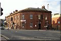
The Townhouse
Large pub on Whitley Road, at the junction with Park Avenue (right). Originally called The Ship, built in 1931 on the site of an older inn (information from old photo on Tynetown http://gallery.tynetown.co.uk/ ).
Image: © Rose and Trev Clough
Taken: 7 Feb 2013
0.11 miles
10

'Wildflower Meadow', Crescent Vale, Whitley Bay
A true wildflower meadow is an area of grass maintained by an annual hay cut. It is made up of perennial plants – species that grow and flower each year, re-appearing from their underground roots each spring. This area of wildflowers lies at the base of a slope which drops down from Marden Road to Crescent Vale and brightens up an otherwise insignificant stretch of grass.
Image: © Geoff Holland
Taken: 14 Jul 2023
0.11 miles