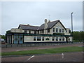
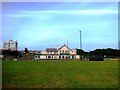
IMAGES TAKEN NEAR TO
Grenada Close, WHITLEY BAY, NE26 1HP
Introduction
This page details the photographs taken nearby to Grenada Close, NE26 1HP by members of the Geograph project.
The Geograph project started in 2005 with the aim of publishing, organising and preserving representative images for every square kilometre of Great Britain, Ireland and the Isle of Man.

There are currently over 7.5m images from over14,400 individuals and you can help contribute to the project by visiting https://www.geograph.org.uk
Image Map
Images are licensed for reuse under creativecommons.org/licenses/by-sa/2.0
Notes
- Clicking on the map will re-center to the selected point.
- The higher the marker number, the further away the image location is from the centre of the postcode.
Image Listing (110 Images Found)
Images are licensed for reuse under creativecommons.org/licenses/by-sa/2.0
Image
Details
Distance
1
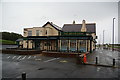
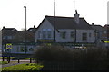
The Briar Dene, Whitley Bay
Named after the adjoining clough. It has a reputation for good beer, but I didn't go in because its kitchen is closed until further notice.
Image: © Bill Boaden
Taken: 16 Sep 2011
0.03 miles
2
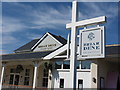
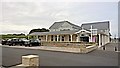
The Briar Dene Bar & Eatery, Whitley Bay
How this has changed since 2013 when Ian S visited here see https://www.geograph.org.uk/photo/3318772. Standing on the site of the former Culvert Inn, named on the 1898 Ordnance Survey Six-Inch map of the area, the old Briar Dene Pub was in the process of redevelopment when, in August 2015, it was devastated by a massive fire. It finally reopened as a re-titled 'Bar & Eatery' in spring 2017. Note the difference in the spelling of 'Briar' from that of 'Brierdene' which lies immediately to the north. For a selection of detailed free to download walking routes in the area visit www.northtynesidewalks.co.uk
Image: © Geoff Holland
Taken: 11 Apr 2020
0.04 miles
4
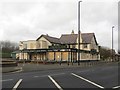
The Briar Dene pub, Whitley Bay
Looking across The Links towards the Briar Dene pub. Image suggests that the pub was still open in 2014, however it clearly isn't now as all the windows are boarded up.
Image: © Graham Robson
Taken: 20 Feb 2016
0.04 miles

7
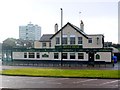
The Briar Dene pub
At one time the steep sides of Brier Dene forced carts travelling from Whitley Bay to Blyth off the lane and onto the beach. The owners of Whitley Lodge Farm built an embankment here in 1840 and installed a tollgate to pay for the work. The embankment was the source of the pub's original name, The Culvert Inn.
The tall building to the left is Beacon House. This 11 storey building dominates the skyline at this end of Whitley Bay. It houses 44 Apartments, 4 to each floor.
Image: © Andrew Curtis
Taken: 26 Dec 2009
0.05 miles
8

The Briar Dene on The Links (road) Whitley Bay
Image: © Ian S
Taken: 2 Feb 2013
0.05 miles