
IMAGES TAKEN NEAR TO
Dowling Avenue, WHITLEY BAY, NE25 8RR
Introduction
This page details the photographs taken nearby to Dowling Avenue, NE25 8RR by members of the Geograph project.
The Geograph project started in 2005 with the aim of publishing, organising and preserving representative images for every square kilometre of Great Britain, Ireland and the Isle of Man.

There are currently over 7.5m images from over14,400 individuals and you can help contribute to the project by visiting https://www.geograph.org.uk
Image Map
Images are licensed for reuse under creativecommons.org/licenses/by-sa/2.0
Notes
- Clicking on the map will re-center to the selected point.
- The higher the marker number, the further away the image location is from the centre of the postcode.
Image Listing (17 Images Found)
Images are licensed for reuse under creativecommons.org/licenses/by-sa/2.0
Image
Details
Distance
1
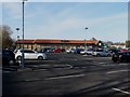
Morrisons supermarket, Whitley Bay
A large Morrisons supermarket and its car park off Hillheads Road.
Image: © Graham Robson
Taken: 24 Feb 2018
0.12 miles
2
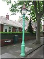
Sewer Gas Lamp, The Grove, Monkseaton
This is one of ten surviving Sewer Gas Lamps erected in the Whitley Bay and Monkseaton area between 1900 and 1910 and is Grade II Listed. Although these lamps were once common features of our streets they are now increasingly rare and those combined with sewer vents are rarer still. It illustrates a technology which once transformed everyday existence. For a selection of detailed free to download walking routes in the area visit www.northtynesidewalks.co.uk
Image: © Geoff Holland
Taken: 18 May 2020
0.14 miles
3
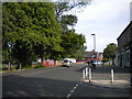
South east end of Marmion Terrace, Monkseaton
Leading to Belvedere Avenue.
Image: © Richard Vince
Taken: 22 Jun 2019
0.14 miles
4
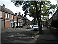
Abbotsford Park, Monkseaton
Off Marmion Terrace.
Image: © Richard Vince
Taken: 22 Jun 2019
0.15 miles
5
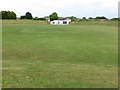
Whitley Bay Cricket Club, Whitley Bay
The Cricket Club was formed in 1926 and the Club's 1st and 2nd XI teams compete in the Tyneside and Northumberland Cricket League. When the first Ordnance Survey Six-Inch map of the area was published in 1865, the area now occupied by the cricket ground formed part of the extensive Whitley Bay Limestone Quarry (Whitley Quarry). The Clubhouse is the white building at the far side of the ground. For a selection of detailed free to download walking routes in the area visit www.northtynesidewalks.co.uk
Image: © Geoff Holland
Taken: 18 May 2020
0.16 miles
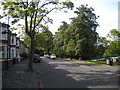
7
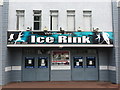
Entrance, Whitley Bay Ice Rink, Hillheads Road, Whitley Bay
Built by the then owner of Durham Ice Rink, Mr. J. Smith (commonly known as 'Icy Smith') at a cost of over £100,000, Whitley Bay Ice Rink opened its doors to the public in May 1955. It is home to Whitley Warriors ice hockey team (formerly known as Whitley Bees) who have, over the years, produced a number of international ice hockey players. It was, for a period, the north east premier concert venue hosting the likes of; Status Quo, AC/DC, The Cure, Wham!, Iron Maiden, KISS, Metallica, Kylie Minogue, New Kids on the Block, Oasis and the Pet Shop Boys. For a selection of detailed free to download walking routes in the area visit www.northtynesidewalks.co.uk
Image: © Geoff Holland
Taken: 18 May 2020
0.18 miles
8
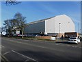
Ice Rink, Hillheads Road, Whitley Bay
A large building housing an ice rink on Hillheads Road. The facility offers public skating as well as being the home rink of the Whitley Warriors ice hockey team.
Image: © Graham Robson
Taken: 24 Feb 2018
0.18 miles
9
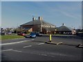
Marden Bridge Sports Centre, Whitley Bay
Looking across Marden Road South to Marden Bridge Sports Centre.
Image: © Graham Robson
Taken: 24 Feb 2018
0.19 miles
10
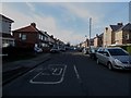
Beverley Road, Whitley Bay
A residential street off Hillheads Road in Whitley Bay.
Image: © Graham Robson
Taken: 24 Feb 2018
0.20 miles