
IMAGES TAKEN NEAR TO
Amble Avenue, WHITLEY BAY, NE25 8PS
Introduction
This page details the photographs taken nearby to Amble Avenue, NE25 8PS by members of the Geograph project.
The Geograph project started in 2005 with the aim of publishing, organising and preserving representative images for every square kilometre of Great Britain, Ireland and the Isle of Man.

There are currently over 7.5m images from over14,400 individuals and you can help contribute to the project by visiting https://www.geograph.org.uk
Image Map
Images are licensed for reuse under creativecommons.org/licenses/by-sa/2.0
Notes
- Clicking on the map will re-center to the selected point.
- The higher the marker number, the further away the image location is from the centre of the postcode.
Image Listing (105 Images Found)
Images are licensed for reuse under creativecommons.org/licenses/by-sa/2.0
Image
Details
Distance
1
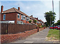
Houses, Cullercoats
On A193, Marden Road South.
Image: © wfmillar
Taken: 13 Jul 2013
0.13 miles
2
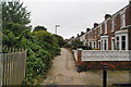
Stanley Crescent
A path along by the railway, now the Metro line, and these houses don't have road access. Some of the land on the left next to the railway is used for gardens and allotments, but most has been allowed to grow wild.
Image: © Bill Boaden
Taken: 17 Sep 2011
0.14 miles
3
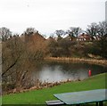
Marden Quarry
The east end of Marden Quarry.
Image: © Antonia
Taken: 20 Jan 2008
0.16 miles
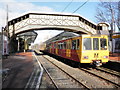
5
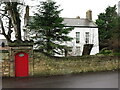
Marden House, Whitley Bay
This fine two storey house, close to Marden Quarry Park, was built, according to William Weaver Tomlinson in his 1893 book, 'Historical Notes on Cullercoats Whitley and Monkseaton', "by Mr. Thomas Taylor early in the century [19th]." It seems that Mr. Taylor was quick to move to pastures new as the property was, "in the Newcastle Courant of July 27th, 1816 advertised to be let ". For a selection of detailed free to download walking routes in the area visit www.northtynesidewalks.co.uk
Image: © Geoff Holland
Taken: 8 Dec 2020
0.19 miles
6

Cullercoats - Southbound station buildings (exterior)
Image: © Dave Bevis
Taken: 10 Apr 2005
0.19 miles
7
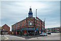
The Cullercoats Co-op in North Shields, Tyne and Wear, Newcastle
The Cullercoats Co-op in North Shields is located in the town centre.
This grocery store is located at 51 John Street and postcode of this location is NE30 4PJ
In April 2019 this store had a significant refurbishment at a cost of £730,000.
Image: © Garry Cornes
Taken: 3 Aug 2019
0.20 miles
8
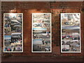
Community Artwork, Cullercoats Metro Station
The Cullercoats Kids’ Art Project was launched in 2017 in a bid to brighten up Cullercoats Metro Station with a series of images that reflect the heritage and beauty of the popular coastal village. The project was a collaboration between Cullercoats Primary School, teacher and artist Chris Howlett, local councillor Karen Lee, North Tyneside Council, professional photographer Veronica Congleton and Nexus. For a selection of detailed free to download walking routes in the area visit www.northtynesidewalks.co.uk
Image: © Geoff Holland
Taken: 30 Jan 2021
0.20 miles

10
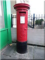
Post Box, Whitley Road, Whitley Bay
This post box dates from the reign of King Edward VII (1901-1910) and is in excellent condition. It stands outside what is currently Oliver's Bookshop. For a selection of detailed free to download walking routes in the area visit www.northtynesidewalks.co.uk
Image: © Geoff Holland
Taken: 30 Jan 2021
0.20 miles