IMAGES TAKEN NEAR TO
Woodside Avenue, WHITLEY BAY, NE25 0HN
Introduction
This page details the photographs taken nearby to Woodside Avenue, NE25 0HN by members of the Geograph project.
The Geograph project started in 2005 with the aim of publishing, organising and preserving representative images for every square kilometre of Great Britain, Ireland and the Isle of Man.

There are currently over 7.5m images from over14,400 individuals and you can help contribute to the project by visiting https://www.geograph.org.uk
Image Map
Images are licensed for reuse under creativecommons.org/licenses/by-sa/2.0
Notes
- Clicking on the map will re-center to the selected point.
- The higher the marker number, the further away the image location is from the centre of the postcode.
Image Listing (9 Images Found)
Images are licensed for reuse under creativecommons.org/licenses/by-sa/2.0
Image
Details
Distance
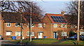
1
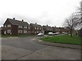
Swarland Avenue, Seaton Delaval
A residential street in Seaton Delaval.
Image: © Graham Robson
Taken: 10 Dec 2016
0.10 miles
2
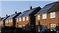
Solar Panels
A row of houses in Seaton Delaval sporting solar panels. Although cost effective and eco-friendly, they do not look particularly attractive!
Image: © Christine Westerback
Taken: 3 Feb 2012
0.11 miles
5
Solar Panels
On some houses along Elsdon Avenue, Seaton Delaval
Image: © Christine Westerback
Taken: 3 Feb 2012
0.14 miles
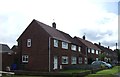
6
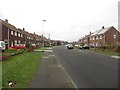
Elsdon Avenue, Seaton Delaval
A quiet residential street in Seaton Delaval.
Image: © Graham Robson
Taken: 10 Dec 2016
0.15 miles
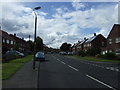
7
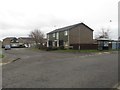
Denham Drive, Seaton Delaval
A residential street off Tillmouth Avenue in Seaton Delaval.
Image: © Graham Robson
Taken: 10 Dec 2016
0.18 miles
8
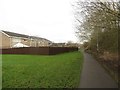
Footpath on the edge of Seaton Delaval
A public footpath on the southern edge of Seaton Delaval, the backs of houses on the left, Holywell Dene on the right.
Image: © Graham Robson
Taken: 10 Dec 2016
0.21 miles
9
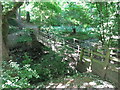
Footbridge over the Seaton Burn, Holywell
This is the same footbridge as is shown at https://www.geograph.org.uk/photo/5260232 but taken from the opposite (northern) side of the burn. For a selection of detailed free to download walking routes in the area visit www.northtynesdiewalks.co.uk
Image: © Geoff Holland
Taken: 2 Jun 2020
0.25 miles