
IMAGES TAKEN NEAR TO
Thorntree Way, BLYTH, NE24 4LS
Introduction
This page details the photographs taken nearby to Thorntree Way, NE24 4LS by members of the Geograph project.
The Geograph project started in 2005 with the aim of publishing, organising and preserving representative images for every square kilometre of Great Britain, Ireland and the Isle of Man.

There are currently over 7.5m images from over14,400 individuals and you can help contribute to the project by visiting https://www.geograph.org.uk
Image Map
Images are licensed for reuse under creativecommons.org/licenses/by-sa/2.0
Notes
- Clicking on the map will re-center to the selected point.
- The higher the marker number, the further away the image location is from the centre of the postcode.
Image Listing (6 Images Found)
Images are licensed for reuse under creativecommons.org/licenses/by-sa/2.0
Image
Details
Distance
1
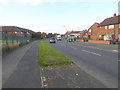
Tynedale Drive, Blyth
One of the cycle paths of the Blyth Town cycle network follows the left hand pavement.
Image: © Oliver Dixon
Taken: 26 Oct 2015
0.15 miles
2
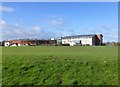
Blyth Community College
In Cowpen District of Blyth.
Image: © Russel Wills
Taken: 22 Feb 2016
0.19 miles
3
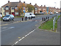
Pinch point on Tynedale Drive, Blyth
Traffic calming measure.
Image: © Oliver Dixon
Taken: 26 Oct 2015
0.23 miles
4
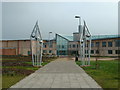
Blyth Community College
Population: 31,800. Northumberland's largest town, with a thrice weekly market. Historically it grew as the major seaport for the export of Northumberland coal.
Image: © Andrew Mitchell
Taken: 13 Jan 2001
0.23 miles
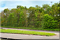
6
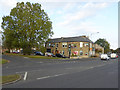
Premier Meats, Cowpen Road, Blyth
Business offering quality meat products to the public at wholesale prices. This branch gives the appearance of having once been a public house.
Image: © Oliver Dixon
Taken: 26 Oct 2015
0.25 miles