
IMAGES TAKEN NEAR TO
Main Street South, CRAMLINGTON, NE23 7SD
Introduction
This page details the photographs taken nearby to Main Street South, NE23 7SD by members of the Geograph project.
The Geograph project started in 2005 with the aim of publishing, organising and preserving representative images for every square kilometre of Great Britain, Ireland and the Isle of Man.

There are currently over 7.5m images from over14,400 individuals and you can help contribute to the project by visiting https://www.geograph.org.uk
Image Map
Images are licensed for reuse under creativecommons.org/licenses/by-sa/2.0
Notes
- Clicking on the map will re-center to the selected point.
- The higher the marker number, the further away the image location is from the centre of the postcode.
Image Listing (31 Images Found)
Images are licensed for reuse under creativecommons.org/licenses/by-sa/2.0
Image
Details
Distance
1
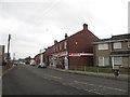
Shops in Seghill
A row of local shops in Main Street in Seghill. They include a Spar convenience store with Post Office and a few takeaways.
Image: © Graham Robson
Taken: 13 Jan 2018
0.01 miles
2
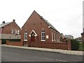
Primitive Methodist Church, Seghill
The Primitive Methodist Church on Main Street in Seghill. It appears to still be in use as a church.
Image: © Graham Robson
Taken: 13 Jan 2018
0.03 miles
4
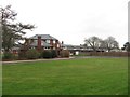
Seghill First School
Part of the building where young local children are educated before moving onto middle school further afield.
Image: © Graham Robson
Taken: 13 Jan 2018
0.04 miles
6
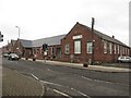
Seghill Institute Community Centre
A large community building on Main Street in Seghill.
Image: © Graham Robson
Taken: 13 Jan 2018
0.05 miles
7
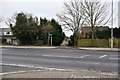
North end of Backworth Waggonway on Main Street, Seghill
Image: © Ron Dixon
Taken: 20 Jan 2017
0.05 miles
9
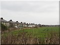
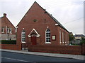
The southern edge of Seghill
The back gardens of houses on The Crescent in Seghill face out onto large arable fields.
Image: © Graham Robson
Taken: 13 Jan 2018
0.07 miles
10
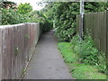
Public Bridleway Near Front Street, Seghill
This public bridleway, which follows the course of the old Cramlington Waggonway (Dudley Branch), begins on Front Street https://www.geograph.org.uk/photo/6531298, and culminates on Station Road. Whilst it is a useful link for walkers and cyclist, it is a rather unusual route for horse riders. For a selection of detailed free to download walking routes in the area visit www.northtynesidewalks.co.uk
Image: © Geoff Holland
Taken: 7 Jul 2020
0.12 miles