IMAGES TAKEN NEAR TO
Weetslade Crescent, CRAMLINGTON, NE23 7LJ
Introduction
This page details the photographs taken nearby to Weetslade Crescent, NE23 7LJ by members of the Geograph project.
The Geograph project started in 2005 with the aim of publishing, organising and preserving representative images for every square kilometre of Great Britain, Ireland and the Isle of Man.

There are currently over 7.5m images from over14,400 individuals and you can help contribute to the project by visiting https://www.geograph.org.uk
Image Map
Images are licensed for reuse under creativecommons.org/licenses/by-sa/2.0
Notes
- Clicking on the map will re-center to the selected point.
- The higher the marker number, the further away the image location is from the centre of the postcode.
Image Listing (13 Images Found)
Images are licensed for reuse under creativecommons.org/licenses/by-sa/2.0
Image
Details
Distance
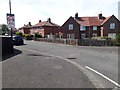
2
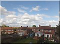
Houses in Westlade Crescent, Dudley
Within commuting range of Newcastle on Tyne.
Beside the East Coast Main Line.
Image: © Russel Wills
Taken: 17 May 2014
0.04 miles
3
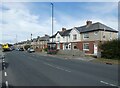
Weetslade Crescent, Dudley
A residential crescent off Weetslade Road in Dudley.
Image: © Graham Robson
Taken: 25 May 2020
0.09 miles
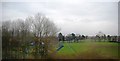
4
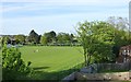
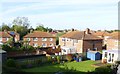
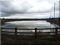
Recreation Ground, Weetslade Road, Dudley
Beside the East Coast Main Line.
Image: © Russel Wills
Taken: 17 May 2014
0.11 miles
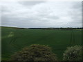
8
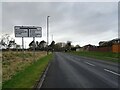
Fordley Bypass (B1321) approaching roundabout
Image: © JThomas
Taken: 13 Feb 2024
0.17 miles