
IMAGES TAKEN NEAR TO
Dipton Grove, CRAMLINGTON, NE23 6DR
Introduction
This page details the photographs taken nearby to Dipton Grove, NE23 6DR by members of the Geograph project.
The Geograph project started in 2005 with the aim of publishing, organising and preserving representative images for every square kilometre of Great Britain, Ireland and the Isle of Man.

There are currently over 7.5m images from over14,400 individuals and you can help contribute to the project by visiting https://www.geograph.org.uk
Image Map
Images are licensed for reuse under creativecommons.org/licenses/by-sa/2.0
Notes
- Clicking on the map will re-center to the selected point.
- The higher the marker number, the further away the image location is from the centre of the postcode.
Image Listing (27 Images Found)
Images are licensed for reuse under creativecommons.org/licenses/by-sa/2.0
Image
Details
Distance
1
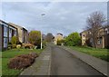
Cycleway, Cramlington
Heading for Seven Oaks Park and the Town Centre.
Image: © Richard Webb
Taken: 26 Jan 2019
0.05 miles
2
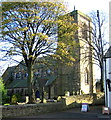
Parish Church of St. Nicholas, Cramlington Village
When this church was built in the 1860's Cramlington was still a small mining village with a history going back before the Conquest. Now it is a suburb of the much larger 'New Town' developed in the 1960's.
Image: © Alan Fearon
Taken: 15 Nov 2005
0.12 miles
3
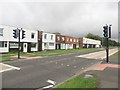
Terraced houses, Allensgreen, Cramlington
A row of terraced houses, part of the Allensgreen estate which backs onto Northumbrian Road. A signalled pedestrian crossing is in the foreground.
Image: © Graham Robson
Taken: 19 Aug 2018
0.15 miles
4

Playground, Cramlington
This children's playground lies in one of the numerous open spaces incorporated in the new town of Cramlington. The town centre can be seen just beyond Dudley Lane.
Image: © Oliver Dixon
Taken: 2 Mar 2010
0.16 miles
5
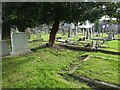
Churchyard, Cramlington
At the centre of the village of Cramlington which predates the new town.
Image: © Richard Webb
Taken: 26 Jan 2019
0.17 miles
6
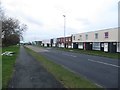
Houses, Allensgreen, Cramlington
Houses on Allensgreen backing onto Northumbrian Way, Cramlington.
Image: © Graham Robson
Taken: 10 Dec 2016
0.17 miles
7
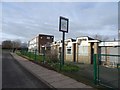
Ready, Set, Grow
A nursery situated in what was once a pub, The Hind. Cramlington. The road is a cyclepath.
Image: © Richard Webb
Taken: 26 Jan 2019
0.18 miles
8
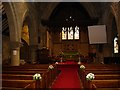
Cramlington St Nicholas
The interior of the church
Image: © Steve M
Taken: 8 Sep 2006
0.18 miles
9

Cramlington St Nicholas
the south facing side of the church
Image: © Steve M
Taken: 13 Nov 2005
0.18 miles
10
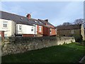
Back of Church Street, Cramlington
Pre new town houses seen from the churchyard.
Image: © Richard Webb
Taken: 26 Jan 2019
0.19 miles