IMAGES TAKEN NEAR TO
Greenholme Close, CRAMLINGTON, NE23 3SU
Introduction
This page details the photographs taken nearby to Greenholme Close, NE23 3SU by members of the Geograph project.
The Geograph project started in 2005 with the aim of publishing, organising and preserving representative images for every square kilometre of Great Britain, Ireland and the Isle of Man.

There are currently over 7.5m images from over14,400 individuals and you can help contribute to the project by visiting https://www.geograph.org.uk
Image Map (Loading...)


Getting Data...Please wait
Leaflet Map data © OpenStreetMap
Images are licensed for reuse under creativecommons.org/licenses/by-sa/2.0
Notes
- Clicking on the map will re-center to the selected point.
- The higher the marker number, the further away the image location is from the centre of the postcode.
Image Listing (9 Images Found)
Images are licensed for reuse under creativecommons.org/licenses/by-sa/2.0
Image
Details
Distance
2
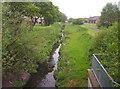
Horton Burn
A view of Horton Burn taken from one of the footbridges that connects the north and south sides of the surrounding housing estate.
Image: © Weston Beggard
Taken: 20 May 2006
0.09 miles
3
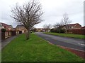
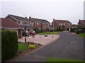
Hauxley Drive
Some of the modern housing that pretty much dominates square NZ2678.
Image: © Weston Beggard
Taken: 20 May 2006
0.09 miles
4
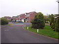
Heswall Road
More modern housing stock next to Horton Burn.
Image: © Weston Beggard
Taken: 20 May 2006
0.09 miles
5
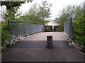
Footbridge
A footbridge over Horton Burn connects the north and south sides of the housing estate.
Image: © Weston Beggard
Taken: 20 May 2006
0.09 miles
6
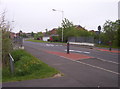
Horton Drive
Horton Drive crosses its namesake, Horton Burn, via this bridge.
Image: © Weston Beggard
Taken: 20 May 2006
0.09 miles
7
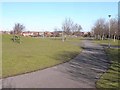
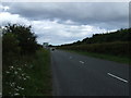
Open space, Cramlington
The new town of Cramlington incorporates many large areas of open public space, including this one to the north of the northern limb of Northumbrian Road.
Image: © Oliver Dixon
Taken: 2 Mar 2010
0.20 miles
8
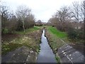
The Horton Burn
More of a drain than a burn now that it runs through a residential area with fast runoff.
Image: © Richard Webb
Taken: 26 Jan 2019
0.23 miles