IMAGES TAKEN NEAR TO
St. Davids Park, CRAMLINGTON, NE23 1BD
Introduction
This page details the photographs taken nearby to St. Davids Park, NE23 1BD by members of the Geograph project.
The Geograph project started in 2005 with the aim of publishing, organising and preserving representative images for every square kilometre of Great Britain, Ireland and the Isle of Man.

There are currently over 7.5m images from over14,400 individuals and you can help contribute to the project by visiting https://www.geograph.org.uk
Image Map
Images are licensed for reuse under creativecommons.org/licenses/by-sa/2.0
Notes
- Clicking on the map will re-center to the selected point.
- The higher the marker number, the further away the image location is from the centre of the postcode.
Image Listing (13 Images Found)
Images are licensed for reuse under creativecommons.org/licenses/by-sa/2.0
Image
Details
Distance
1
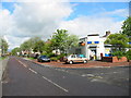
Nelson Village, South East Northumberland
The village owes its name to the nearby but long since closed Nelson Colliery.
The photograph shows the Post Office / general store on Arcot Avenue.
Image: © Chris Tweedy
Taken: 1 May 2003
0.18 miles
2
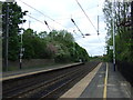
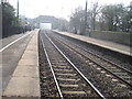
East Coast Main Line heading north from Cramlington Station
Image: © JThomas
Taken: 2 Jun 2012
0.20 miles
3
Building site, Cramlington
A former field to the north of Station Road is having houses built upon it. They will be very handy for the railway station.
Image: © Richard Webb
Taken: 26 Jan 2019
0.21 miles
4
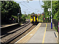
Train arriving at Cramlington
A class 156 unit on a service from Morpeth to Gateshead Metro Centre.
Image: © John Lucas
Taken: 16 Aug 2016
0.22 miles
5
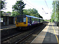
Cramlington Railway Station
Northern Rail service leaving for Chathill.
Diesel multiple unit 142 (DMU). Number 55714
Image: © JThomas
Taken: 28 Jul 2012
0.22 miles
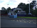
8
Development site, Cramlington
A former field, awaiting development. This is the corner of Crow Hall Lane (A1171) and Station Road (foreground).
Image: © Richard Webb
Taken: 26 Jan 2019
0.23 miles
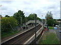
9
Cramlington railway station, Northumberland
Opened in 1847 by the Newcastle & Berwick Railway. View south towards Annitsford and Newcastle. The main station building used to be on the left.
Image: © Nigel Thompson
Taken: 24 Mar 2012
0.24 miles
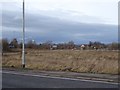
10
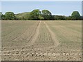
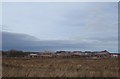
Arable field in Cramlington
An arable field which is more or less surrounded by development. The crop in the field is probably spring barley.
Image: © Graham Robson
Taken: 15 May 2016
0.25 miles