IMAGES TAKEN NEAR TO
East Sleekburn, BEDLINGTON, NE22 7FG
Introduction
This page details the photographs taken nearby to NE22 7FG by members of the Geograph project.
The Geograph project started in 2005 with the aim of publishing, organising and preserving representative images for every square kilometre of Great Britain, Ireland and the Isle of Man.

There are currently over 7.5m images from over14,400 individuals and you can help contribute to the project by visiting https://www.geograph.org.uk
Image Map
Images are licensed for reuse under creativecommons.org/licenses/by-sa/2.0
Notes
- Clicking on the map will re-center to the selected point.
- The higher the marker number, the further away the image location is from the centre of the postcode.
Image Listing (10 Images Found)
Images are licensed for reuse under creativecommons.org/licenses/by-sa/2.0
Image
Details
Distance
1
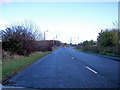
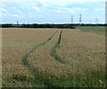
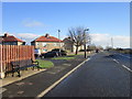
Brock Lane East Sleekburn
This road leads to the former Blyth Power Station at Cambois
Image: © george hurrell
Taken: 11 Nov 2006
0.06 miles
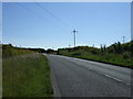
7
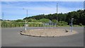
Roundabout without a junction
I think this is related to either past opencast mining or future industrial development, straight on is the only option.
Image: © Richard Webb
Taken: 31 Jul 2012
0.16 miles
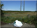
10
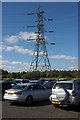
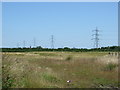
Electricity Pylon near Cambois
The parked cars in the foreground are here to see the Tall Ships Regatta. This is the Northern Park and Ride site.
Image: © Mark Anderson
Taken: 29 Aug 2016
0.25 miles