IMAGES TAKEN NEAR TO
BEDLINGTON, NE22 7BE
Introduction
This page details the photographs taken nearby to NE22 7BE by members of the Geograph project.
The Geograph project started in 2005 with the aim of publishing, organising and preserving representative images for every square kilometre of Great Britain, Ireland and the Isle of Man.

There are currently over 7.5m images from over14,400 individuals and you can help contribute to the project by visiting https://www.geograph.org.uk
Image Map
Images are licensed for reuse under creativecommons.org/licenses/by-sa/2.0
Notes
- Clicking on the map will re-center to the selected point.
- The higher the marker number, the further away the image location is from the centre of the postcode.
Image Listing (12 Images Found)
Images are licensed for reuse under creativecommons.org/licenses/by-sa/2.0
Image
Details
Distance
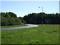
1
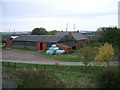
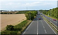
Binnie's Farm
Sleekburn Grange Farm taken from A189 flyover.
Image: © george hurrell
Taken: 7 Nov 2006
0.01 miles
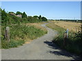
2
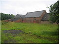
Sleekburn Grange Farm
Outbuildings seen from the access lane to Mount Pleasant Farm, just below the A189 trunk road.
Image: © Chris Heaton
Taken: 19 Aug 2008
0.01 miles
7
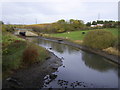
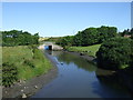
River
Burn at East Sleekburn Bridge carrying 189 Spine Road. This burn leads into the River Blyth.
Image: © george hurrell
Taken: 12 Nov 2006
0.17 miles
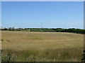
9
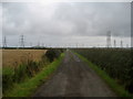
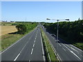
Many Pylons have I Seen
A veritable forest of pylons encroach around this access track to Mount Pleasant Farm from East Sleekburn.
Image: © Chris Heaton
Taken: 19 Aug 2008
0.22 miles