IMAGES TAKEN NEAR TO
BEDLINGTON, NE22 7AE
Introduction
This page details the photographs taken nearby to NE22 7AE by members of the Geograph project.
The Geograph project started in 2005 with the aim of publishing, organising and preserving representative images for every square kilometre of Great Britain, Ireland and the Isle of Man.

There are currently over 7.5m images from over14,400 individuals and you can help contribute to the project by visiting https://www.geograph.org.uk
Image Map
Images are licensed for reuse under creativecommons.org/licenses/by-sa/2.0
Notes
- Clicking on the map will re-center to the selected point.
- The higher the marker number, the further away the image location is from the centre of the postcode.
Image Listing (14 Images Found)
Images are licensed for reuse under creativecommons.org/licenses/by-sa/2.0
Image
Details
Distance
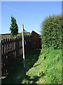
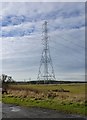
4
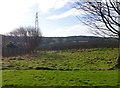
Pylon south of Bomarsund Farm
With pasture and arable fields.
Image: © Russel Wills
Taken: 19 Feb 2016
0.06 miles
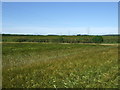
9
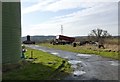
Pylon near Bomarsund Farm
With various farm equipment!
Image: © Russel Wills
Taken: 19 Feb 2016
0.10 miles
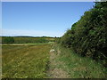
10
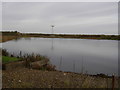
Fishing Lake
Fishing Lake at Earth Balance Bomarsund, Stakeford.
Image: © george hurrell
Taken: 12 Nov 2006
0.11 miles