IMAGES TAKEN NEAR TO
Rosebery Place, NEWCASTLE UPON TYNE, NE2 1ES
Introduction
This page details the photographs taken nearby to Rosebery Place, NE2 1ES by members of the Geograph project.
The Geograph project started in 2005 with the aim of publishing, organising and preserving representative images for every square kilometre of Great Britain, Ireland and the Isle of Man.

There are currently over 7.5m images from over14,400 individuals and you can help contribute to the project by visiting https://www.geograph.org.uk
Image Map
Images are licensed for reuse under creativecommons.org/licenses/by-sa/2.0
Notes
- Clicking on the map will re-center to the selected point.
- The higher the marker number, the further away the image location is from the centre of the postcode.
Image Listing (77 Images Found)
Images are licensed for reuse under creativecommons.org/licenses/by-sa/2.0
Image
Details
Distance
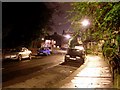
1
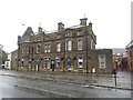
The Punch Bowl, Jesmond Road, Newcastle upon Tyne
Looking across the Cradlewell Bypass towards the currently closed Punch Bowl pub.
Image: © Graham Robson
Taken: 16 Oct 2016
0.04 miles
3
The Punch Bowl, Jesmond Road
There is another photo here Image
Image: © Andrew Curtis
Taken: 9 Aug 2013
0.05 miles
4

Closed pub, Jesmond Road, Newcastle
The former Cradlwell Hotel pub on Jesmond Road, appearing to have been closed for while. Behind the pub frontage the building appears to have been redeveloped into apartments, however, work seems to have ground to a halt.
Image: © Graham Robson
Taken: 16 Oct 2016
0.08 miles
5
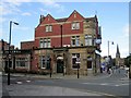
The Cradlewell, Deuchar Street, Jesmond
The pub is on the corner of Jesmond Road and Deuchar Street.
The latter is named after Robert Deuchar (1831-1904), Brewer and Property Speculator http://www.jesmondoldcemetery.co.uk/deuchar_25.html
Image: © Andrew Curtis
Taken: 9 Sep 2010
0.09 miles
6
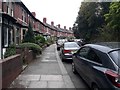
Rosebery Crescent, Jesmond, Newcastle upon Tyne
A gently curving residential street in the Jesmond area of Newcastle.
Image: © Graham Robson
Taken: 26 Apr 2020
0.09 miles
7
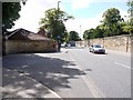
Sandyford Road
The wall of Jesmond Old Cemetery is on the right side.
Image: © Andrew Curtis
Taken: 9 Aug 2013
0.11 miles
8
Rosebery Crescent
Affluent street in the Jesmond area of Newcastle-upon-Tyne.
Image: © Stephen Sweeney
Taken: 15 Jan 2009
0.12 miles
9
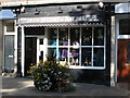
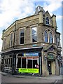
The Dress Studio and Hat Hire, Jesmond Road
Image: © Mike Quinn
Taken: 10 Sep 2009
0.14 miles
10
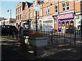
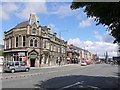
Jesmond Road
Shows the location of Image, and of Image and other shops and cafes in Jesmond Road south of its junctiuon with Osborne Avenue.
Image: © Mike Quinn
Taken: 10 Sep 2009
0.14 miles