IMAGES TAKEN NEAR TO
Staith Lane, BLAYDON-ON-TYNE, NE21 4LF
Introduction
This page details the photographs taken nearby to Staith Lane, NE21 4LF by members of the Geograph project.
The Geograph project started in 2005 with the aim of publishing, organising and preserving representative images for every square kilometre of Great Britain, Ireland and the Isle of Man.

There are currently over 7.5m images from over14,400 individuals and you can help contribute to the project by visiting https://www.geograph.org.uk
Image Map
Images are licensed for reuse under creativecommons.org/licenses/by-sa/2.0
Notes
- Clicking on the map will re-center to the selected point.
- The higher the marker number, the further away the image location is from the centre of the postcode.
Image Listing (26 Images Found)
Images are licensed for reuse under creativecommons.org/licenses/by-sa/2.0
Image
Details
Distance
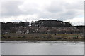
3
Stella Lodge, Stella Hall Drive
The original lodge to the Stella estate, my parents first house
Image: © Alex McGregor
Taken: 21 Apr 2010
0.10 miles
4
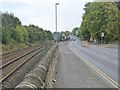
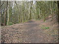
Keelman's Way alongside Stella Road
The Keelman's Way (National Cycle Network route 141) is a riverside foot- and cycle-path which runs the width of Gateshead Borough along the south bank of the Tyne. Here it runs along the narrow footway on the north side of Stella Road (B6317) - not an pleasant prospect. Why it has not been diverted onto much more level and attractive riverside path past the Stella Riverside estate is not clear. The Carlisle to Newcastle railway runs to the left.
Image: © Oliver Dixon
Taken: 27 Sep 2017
0.11 miles
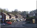
5
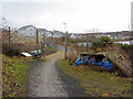
Route of Towneley Main Waggonway
Looking downhill on the route of the waggonway on which coal from Emma Pit and Stargate Pit was transported to Stella Staith on the River Tyne.
Image: © Adrian Featherstone
Taken: 22 Apr 2013
0.12 miles
6
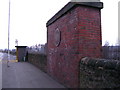
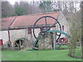
Stella Staith
Little evidence remains of the Towneley Main Waggonway which brought coal from Stargate Pit to the River Tyne at Stella Staith (without an e). The plaque on this support for the waggonway does not refer to the mining heritage of the area but to Blaydon Races which were run on nearby Blaydon Island and Stella Haugh.
Image: © David Rogers
Taken: 21 Mar 2009
0.12 miles
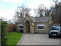
10
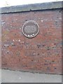
Memorial to the Blaydon Races
The plaque on this short length of wall was erected by the Winlaton Local History Society and commemorates the Blaydon Races, immortalised in a song of the same title. The plaque reads:
Blaydon Races
Official racing started in 1861 on Blaydon island which lay North of here. The song was written in 1862. From 1887 to 1914 the race course was on Stella Haugh, the site of the former Power station.
Image: © Oliver Dixon
Taken: 27 Sep 2017
0.14 miles