IMAGES TAKEN NEAR TO
Western Way, NEWCASTLE UPON TYNE, NE20 9ND

Introduction

This page details the photographs taken nearby to Western Way, NE20 9ND by members of the Geograph project.

The Geograph project started in 2005 with the aim of publishing, organising and preserving representative images for every square kilometre of Great Britain, Ireland and the Isle of Man.

There are currently over 7.5m images from over14,400 individuals and you can help contribute to the project by visiting https://www.geograph.org.uk

Image Map


Images are licensed for reuse under creativecommons.org/licenses/by-sa/2.0
Notes
  • Clicking on the map will re-center to the selected point.
  • The higher the marker number, the further away the image location is from the centre of the postcode.

Image Listing (7 Images Found)

Images are licensed for reuse under creativecommons.org/licenses/by-sa/2.0
Image
Details
Distance
1
Western Way, Darras Hall, Ponteland
Looking south from near the junction with Edgehill.
Image: © Phil Thirkell Taken: 4 Jan 2006
0.02 miles
2
Western Way Garage
Unusual to see a garage surviving on a yellow road, but Darras Hall is very near.
Image: © Richard Webb Taken: 1 Oct 2015
0.18 miles
3
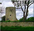
Windmill, Birney Hill Farm
Image: © Phil Thirkell Taken: 4 Jan 2006
0.20 miles
4
Road Junction on Stamfordham Road
The road junction between Western Way and Stamfordham Road a short distance to the south of Darras Hall.
Image: © Graham Robson Taken: 23 Sep 2017
0.21 miles
5
Stamfordham Drive
Heading north west.
Image: © JThomas Taken: 9 Apr 2015
0.22 miles
6
Windmill
Another pic of the windmill, it looks as if it may have been lived in at one time. Note the curtains in the bottom window.
Image: © Newbiggin Hall Scouts Taken: 30 Mar 2007
0.24 miles
7
Hadrian Road, Darras Hall
A junction between residential roads in the Darras Hall estate.
Image: © Graham Robson Taken: 23 Sep 2017
0.25 miles