IMAGES TAKEN NEAR TO
Ashdale, NEWCASTLE UPON TYNE, NE20 9DR
Introduction
This page details the photographs taken nearby to Ashdale, NE20 9DR by members of the Geograph project.
The Geograph project started in 2005 with the aim of publishing, organising and preserving representative images for every square kilometre of Great Britain, Ireland and the Isle of Man.

There are currently over 7.5m images from over14,400 individuals and you can help contribute to the project by visiting https://www.geograph.org.uk
Image Map
Images are licensed for reuse under creativecommons.org/licenses/by-sa/2.0
Notes
- Clicking on the map will re-center to the selected point.
- The higher the marker number, the further away the image location is from the centre of the postcode.
Image Listing (13 Images Found)
Images are licensed for reuse under creativecommons.org/licenses/by-sa/2.0
Image
Details
Distance
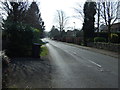
1
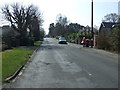
Woodside, Darras Hall, Ponteland
Looking south.
Image: © JThomas
Taken: 9 Apr 2015
0.09 miles
2
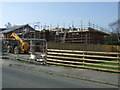
New house building on Woodside, Darras Hall, Ponteland
Image: © JThomas
Taken: 9 Apr 2015
0.12 miles
3
Bus stop on Woodside, Darras Hall, Ponteland
Image: © JThomas
Taken: 9 Apr 2015
0.14 miles
5
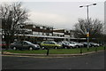
Shopping centre, Darras Hall, Ponteland
Image: © Phil Thirkell
Taken: 13 Jan 2006
0.20 miles
6
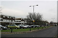
Shopping centre, Darras Hall, Ponteland
Image: © Phil Thirkell
Taken: 13 Jan 2006
0.20 miles
7
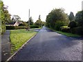
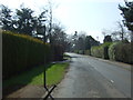
Whinfell Road, Darras Hall
Woodlands is the road on the left Image
Image: © Andrew Curtis
Taken: 24 Sep 2010
0.20 miles
8
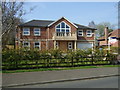
Large house to let on Woodside, Darras Hall, Ponteland
Image: © JThomas
Taken: 9 Apr 2015
0.20 miles
9
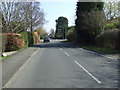
Woodside, Darras Hall, Ponteland
Looking south.
Image: © JThomas
Taken: 9 Apr 2015
0.22 miles
10
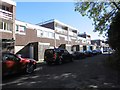
Behind the shops
Service road, Broadway, Darras Hall.
Image: © Richard Webb
Taken: 1 Oct 2015
0.23 miles