IMAGES TAKEN NEAR TO
Low Westwood, NEWCASTLE UPON TYNE, NE17 7PZ
Introduction
This page details the photographs taken nearby to NE17 7PZ by members of the Geograph project.
The Geograph project started in 2005 with the aim of publishing, organising and preserving representative images for every square kilometre of Great Britain, Ireland and the Isle of Man.

There are currently over 7.5m images from over14,400 individuals and you can help contribute to the project by visiting https://www.geograph.org.uk
Image Map (Loading...)


Getting Data...Please wait
Leaflet Map data © OpenStreetMap
Images are licensed for reuse under creativecommons.org/licenses/by-sa/2.0
Notes
- Clicking on the map will re-center to the selected point.
- The higher the marker number, the further away the image location is from the centre of the postcode.
Image Listing (11 Images Found)
Images are licensed for reuse under creativecommons.org/licenses/by-sa/2.0
Image
Details
Distance
1
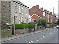
Sherburn Terrace, Low Westwood, Hamsterley
On the A694 Consett to Newcastle main road in the floor of the Derwent valley.
Image: © Oliver Dixon
Taken: 9 Apr 2007
0.05 miles
2
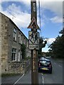
Pre-Worboys School Warning Sign, Low Westwood
Image: © Anthony Foster
Taken: 26 Sep 2021
0.07 miles
3
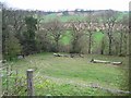
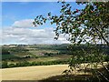
Derwent valley at Low Westwood, Hamsterley
Seen from the A694 Consett to Newcastle road.
Image: © Oliver Dixon
Taken: 9 Apr 2007
0.07 miles
5
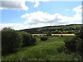
View looking across the river north of Ebchester
This piece of land is called The Haughs. This is an old medieval term for a flat area of land beside a river, which fits the bill exactly here. Viewed looking east from the path south of Broad Oak Farm.
Image: © Robert Graham
Taken: 21 Jun 2019
0.11 miles
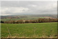
7
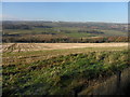
Looking across the Derwent Valley
View north from Shaw Lane near Ebchester across to the north side of the valley. The big farmstead of Broad Oak is prominent in the centre.
Image: © Robert Graham
Taken: 5 Sep 2022
0.18 miles
8
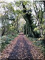
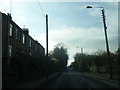
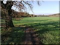
Derwent Walk between Hamsterley & Ebchester
Image: © David Robinson
Taken: 1 Nov 2022
0.21 miles
9
Arable farmland near Broad Oak Farm
Image: © Clive Nicholson
Taken: 14 Apr 2018
0.21 miles
10
Trees, fence and field near High Westwood
Image: © P Glenwright
Taken: 24 Feb 2007
0.22 miles