IMAGES TAKEN NEAR TO
Greenhead Terrace, NEWCASTLE UPON TYNE, NE17 7AH
Introduction
This page details the photographs taken nearby to Greenhead Terrace, NE17 7AH by members of the Geograph project.
The Geograph project started in 2005 with the aim of publishing, organising and preserving representative images for every square kilometre of Great Britain, Ireland and the Isle of Man.

There are currently over 7.5m images from over14,400 individuals and you can help contribute to the project by visiting https://www.geograph.org.uk
Image Map
Images are licensed for reuse under creativecommons.org/licenses/by-sa/2.0
Notes
- Clicking on the map will re-center to the selected point.
- The higher the marker number, the further away the image location is from the centre of the postcode.
Image Listing (14 Images Found)
Images are licensed for reuse under creativecommons.org/licenses/by-sa/2.0
Image
Details
Distance
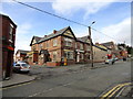
3
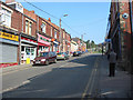
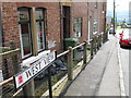
Chopwell
The main street of Chopwell, a pit village in Co. Durham.
No mines or pits there now of course.
Image: © Chris Tweedy
Taken: 29 Mar 2003
0.12 miles
5
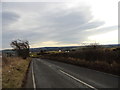
Looking back down Greenhead Road
You can see for ever from up here!
Image: © Robert Graham
Taken: 23 Feb 2012
0.14 miles
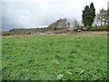
6
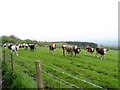
Cattle north of Newhouse Farm, Consett
These look like young beef cattle. On a pasture north of the village.
Image: © Robert Graham
Taken: 30 Apr 2014
0.16 miles
8
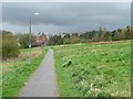
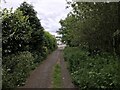
Path to Whittonstall Road
Chopwell was categorised as a "category D village" by Durham County Council. With the decline of coal-mining locally, 114 villages were classified in this way in 1951, and another seven in 1964, including Chopwell. They were left to wither and die, without economic assistance or development. The policy ended in 1977, but many still have an old fashioned air, contrasting with newer areas of commuter housing.
Image: © Christine Johnstone
Taken: 12 Apr 2012
0.23 miles
10
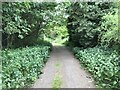
Open land south of the allotments, Chopwell
Chopwell was categorised as a "category D village" by Durham County Council. With the decline of coal-mining locally, 114 villages were classified in this way in 1951, and another seven in 1964, including Chopwell. They were left to wither and die, without economic assistance or development. The policy ended in 1977, but many still have an old fashioned air, contrasting with newer areas of commuter housing.
Image: © Christine Johnstone
Taken: 12 Apr 2012
0.24 miles