IMAGES TAKEN NEAR TO
NE16 6EU
Introduction
This page details the photographs taken nearby to NE16 6EU by members of the Geograph project.
The Geograph project started in 2005 with the aim of publishing, organising and preserving representative images for every square kilometre of Great Britain, Ireland and the Isle of Man.

There are currently over 7.5m images from over14,400 individuals and you can help contribute to the project by visiting https://www.geograph.org.uk
Image Map
Images are licensed for reuse under creativecommons.org/licenses/by-sa/2.0
Notes
- Clicking on the map will re-center to the selected point.
- The higher the marker number, the further away the image location is from the centre of the postcode.
Image Listing (8 Images Found)
Images are licensed for reuse under creativecommons.org/licenses/by-sa/2.0
Image
Details
Distance
2
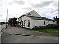
The Hobson
Well known local pub in this former mining village near Stanley.
Image: © Robert Graham
Taken: 8 Aug 2012
0.09 miles
3
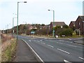
Shared-use path crossing of Syke Road
This shared-use path forms part of Regional Route 11 of the National Cycle Network, which for the most part follows the trackbed of the old Bowes Railway.
Over this section it appears to have diverged from the line of the railway and runs along the footway of the busy Syke Road, crossing to the east side by this refuge near the junction with the Meadows.
Image: © Oliver Dixon
Taken: 28 Feb 2014
0.16 miles
4
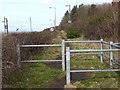
Foot- and cycle-path alongside Syke Road
This path forms part of Regional Route 11 of the National Cycle Network, which for the most part follows the trackbed of the old Bowes Railway.
Over this section it appears to have diverged from the line of the railway and runs behind the hedgerow parallel to the busy Syke Road.
Image: © Oliver Dixon
Taken: 28 Feb 2014
0.16 miles
6
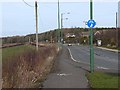
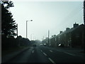
Syke Road, Hobson
This shared-use path forms part of Regional Route 11 of the National Cycle Network, which for the most part follows the trackbed of the old Bowes Railway.
Over this section it appears to have diverged from the line of the railway and runs along the footway of the busy Syke Road.
Image: © Oliver Dixon
Taken: 28 Feb 2014
0.20 miles
7
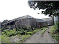
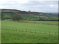
Townhead Farm
Old farm at The Hobson. Dates back to the early 19th century.
Image: © Robert Graham
Taken: 5 Aug 2014
0.21 miles