IMAGES TAKEN NEAR TO
Highfield, NEWCASTLE UPON TYNE, NE16 5NQ
Introduction
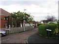
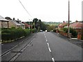
This page details the photographs taken nearby to Highfield, NE16 5NQ by members of the Geograph project.
The Geograph project started in 2005 with the aim of publishing, organising and preserving representative images for every square kilometre of Great Britain, Ireland and the Isle of Man.

There are currently over 7.5m images from over14,400 individuals and you can help contribute to the project by visiting https://www.geograph.org.uk
Image Map (Loading...)


Getting Data...Please wait
Leaflet Map data © OpenStreetMap
Images are licensed for reuse under creativecommons.org/licenses/by-sa/2.0
Notes
- Clicking on the map will re-center to the selected point.
- The higher the marker number, the further away the image location is from the centre of the postcode.
Image Listing (4 Images Found)
Images are licensed for reuse under creativecommons.org/licenses/by-sa/2.0
Image
Details
Distance
4
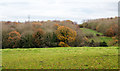
Deciduous woodland on east side of Black Burn
The Black Burn runs in the obvious groove between the field and the trees in this view from the B6316 between Whickham and Sunniside, both parts of Gateshead.
Image: © Trevor Littlewood
Taken: 21 Nov 2017
0.24 miles