IMAGES TAKEN NEAR TO
Hawkwell Close, NEWCASTLE UPON TYNE, NE15 9QJ
Introduction
This page details the photographs taken nearby to Hawkwell Close, NE15 9QJ by members of the Geograph project.
The Geograph project started in 2005 with the aim of publishing, organising and preserving representative images for every square kilometre of Great Britain, Ireland and the Isle of Man.

There are currently over 7.5m images from over14,400 individuals and you can help contribute to the project by visiting https://www.geograph.org.uk
Image Map
Images are licensed for reuse under creativecommons.org/licenses/by-sa/2.0
Notes
- Clicking on the map will re-center to the selected point.
- The higher the marker number, the further away the image location is from the centre of the postcode.
Image Listing (53 Images Found)
Images are licensed for reuse under creativecommons.org/licenses/by-sa/2.0
Image
Details
Distance
1
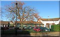
Throckley Primary Care Centre, Tillmouth Park Road
Image: © Andrew Curtis
Taken: 14 Nov 2013
0.03 miles
2
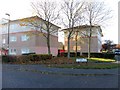
Apartment blocks on corner of Tillmouth Park Road & Hawkwell Rise, Throckley
Image: © Andrew Curtis
Taken: 14 Nov 2013
0.04 miles
3
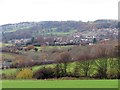
Throckley & Heddon from above Walbottle
Image: © Andrew Curtis
Taken: 1 Dec 2013
0.05 miles
4
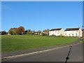
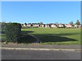
Recreation Ground from Tillmouth Park Road
The houses on the right are on Broomy Hill Road.
Image: © Andrew Curtis
Taken: 14 Nov 2013
0.07 miles
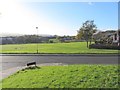
5
Recreation Ground from Tillmouth Park Road
Image: © Andrew Curtis
Taken: 14 Nov 2013
0.07 miles
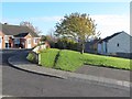
6
Recreation Ground off Broomy Hill Road
Image: © Andrew Curtis
Taken: 14 Nov 2013
0.08 miles
7
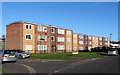
Apartment blocks, Tillmouth Park Road, Throckley
Image: © Andrew Curtis
Taken: 14 Nov 2013
0.09 miles
9
Path on the line of former waggonway above Broomy Hill Road
Image: © Andrew Curtis
Taken: 14 Nov 2013
0.11 miles
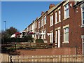
10
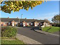
Deneside Close, off Broomy Hill Road, Throckley
Image: © Andrew Curtis
Taken: 14 Nov 2013
0.12 miles