
IMAGES TAKEN NEAR TO
Stuart Gardens, NEWCASTLE UPON TYNE, NE15 9LT
Introduction
This page details the photographs taken nearby to Stuart Gardens, NE15 9LT by members of the Geograph project.
The Geograph project started in 2005 with the aim of publishing, organising and preserving representative images for every square kilometre of Great Britain, Ireland and the Isle of Man.

There are currently over 7.5m images from over14,400 individuals and you can help contribute to the project by visiting https://www.geograph.org.uk
Image Map
Images are licensed for reuse under creativecommons.org/licenses/by-sa/2.0
Notes
- Clicking on the map will re-center to the selected point.
- The higher the marker number, the further away the image location is from the centre of the postcode.
Image Listing (77 Images Found)
Images are licensed for reuse under creativecommons.org/licenses/by-sa/2.0
Image
Details
Distance
1
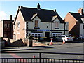
Falmouth House, Hexham Road, Throckley
Masonic Hall.
Image: © Andrew Curtis
Taken: 27 Mar 2015
0.05 miles
3
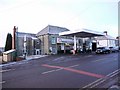
Throckley Filling Station, Hexham Road, Throckley
Image: © Andrew Curtis
Taken: 21 Jan 2011
0.06 miles
4
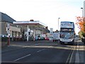
Hexham Road, Throckley
Throckley Filling Station is on the left. A number 22 bus, which terminates at Throckley with a loop round Coach Road, is on the right.
Image: © Andrew Curtis
Taken: 14 Nov 2013
0.06 miles
5
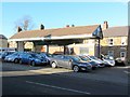
Used car sales & Stephenson Terrace, Throckley
County Direct Cars operate from a former garage forecourt on Hexham Road.
Image: © Andrew Curtis
Taken: 14 Nov 2013
0.08 miles
6
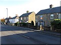
Rosewood Cottages, Hexham Road, Throckley
Image: © Andrew Curtis
Taken: 14 Nov 2013
0.08 miles
7
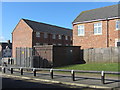
Electricity Sub-Station, off Hexham Road, Throckley
Former air-raid shelter to the north-east of the Victorian school (now demolished), built during World War 2. This was one of a number of shelters on the school site, but the others along the northern edge of the yard have been demolished. It was converted to use as an electricity substation in 1947.
Tyne and Wear HER (5478): Throckley, Middle School, Air Raid Shelter http://www.twsitelines.info
Image: © Andrew Curtis
Taken: 27 Mar 2015
0.09 miles
8
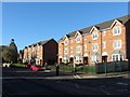
Apartment blocks, Hexham Road, Throckley
Image: © Andrew Curtis
Taken: 14 Nov 2013
0.09 miles
9
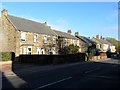
Hexham Road, Throckley
The stone-built building on the left is Oaklands West and East Cottages. Next door are Roseworth Cottages Image
Image: © Andrew Curtis
Taken: 14 Nov 2013
0.09 miles
10
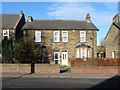
Roseworth Cottages, Hexham Road, Throckley
Image: © Andrew Curtis
Taken: 14 Nov 2013
0.10 miles