
IMAGES TAKEN NEAR TO
Sugley Drive, NEWCASTLE UPON TYNE, NE15 8RD
Introduction
This page details the photographs taken nearby to Sugley Drive, NE15 8RD by members of the Geograph project.
The Geograph project started in 2005 with the aim of publishing, organising and preserving representative images for every square kilometre of Great Britain, Ireland and the Isle of Man.

There are currently over 7.5m images from over14,400 individuals and you can help contribute to the project by visiting https://www.geograph.org.uk
Image Map
Images are licensed for reuse under creativecommons.org/licenses/by-sa/2.0
Notes
- Clicking on the map will re-center to the selected point.
- The higher the marker number, the further away the image location is from the centre of the postcode.
Image Listing (48 Images Found)
Images are licensed for reuse under creativecommons.org/licenses/by-sa/2.0
Image
Details
Distance
1
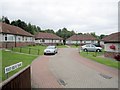
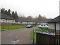
Wedgwood Cottage Homes, Lemington
Twelve, two bedroom bungalows for the elderly, built by North Eastern Railway Co. in 1936 http://en.wikipedia.org/wiki/North_Eastern_Railway_%28UK%29
Image: © Andrew Curtis
Taken: 28 Jul 2010
0.03 miles
3
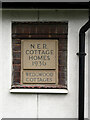
Plaque, Wedgwood Cottage Homes, Lemington
Plaque on cottages:
N.E.R. Cottage Homes 1936
Wedgwood Cottages
Image: © Andrew Curtis
Taken: 6 Aug 2023
0.04 miles
4

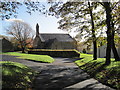
Wedgwood Cottage Homes, Lemington
See description here: Image
Image: © Andrew Curtis
Taken: 6 Aug 2023
0.04 miles
8
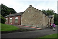
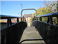
Parish Hall, Church of Holy Saviour, Lemington
Parish school, now hall. 1838; possibly by Benjamin Green. Coursed squared sandstone with ashlar dressings, plinth and quoins; Welsh slate roof with overlapping stone gable copings on moulded kneelers. One high storey, three bays by one. Renewed central door recessed in elliptical-headed double-chamfered surround under floating cornice in low-pitched gabled porch with sundial finial. Floating cornices also to flanking 3-light chamfered stone-mullioned windows. Slit windows in return gable peaks. Ashlar left end chimney, low and coped. Rear brick extension not of interest. LISTED GRADE 2
https://sitelines.newcastle.gov.uk/SMR/8915
Image: © Andrew Curtis
Taken: 6 Aug 2023
0.07 miles
10
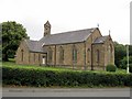
Holy Saviour Church, Lemington
Holy Saviour Church was originally called Sugley Parish Church when it was built in 1837. It was designed by Benjamin Green. It is said to have been oriented north-south, rather than east-west, to avoid an unused pit shaft underneath http://www.lemingtoncentre.co.uk/wb/pages/heritage.php
This church and Image stand on opposite sides of the narrow, heavily wooded Sugley Dene http://newcastlephotos.blogspot.com/2007/06/sugley-dene.html
Image: © Andrew Curtis
Taken: 28 Jul 2010
0.07 miles