IMAGES TAKEN NEAR TO
Ottershaw, NEWCASTLE UPON TYNE, NE15 7XP
Introduction
This page details the photographs taken nearby to Ottershaw, NE15 7XP by members of the Geograph project.
The Geograph project started in 2005 with the aim of publishing, organising and preserving representative images for every square kilometre of Great Britain, Ireland and the Isle of Man.

There are currently over 7.5m images from over14,400 individuals and you can help contribute to the project by visiting https://www.geograph.org.uk
Image Map
Images are licensed for reuse under creativecommons.org/licenses/by-sa/2.0
Notes
- Clicking on the map will re-center to the selected point.
- The higher the marker number, the further away the image location is from the centre of the postcode.
Image Listing (40 Images Found)
Images are licensed for reuse under creativecommons.org/licenses/by-sa/2.0
Image
Details
Distance
1
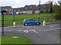
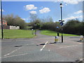
Crossing of Neptune Road
At this point Hadrian's Way, a path from Wylam to Newcastle along the north bank of the Tyne which carries both Hadrian's Cycleway
http://www.cycle-routes.org/HADRIANSCYCLEWAY/and Hadrian's Wall National Trail http://www.nationaltrail.co.uk/hadrianswall/crosses Neptune Road, Lemington.
Image: © Oliver Dixon
Taken: 8 Nov 2008
0.11 miles
2
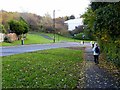
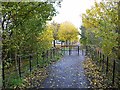
Hadrian's Way and Neptune Road
Hadrian's Way, a path from Wylam to Newcastle along the north bank of the Tyne which carries both Hadrian's Cycleway
http://www.cycle-routes.org/HADRIANSCYCLEWAY/and Hadrian's Wall National Trail http://www.nationaltrail.co.uk/hadrianswall/ here crosses Neptune Road, Lemington. The approaching figure in reflective waistcoat was engaged on a user survey of path users.
Image: © Oliver Dixon
Taken: 8 Nov 2008
0.11 miles
5
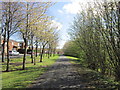
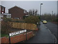
Cyclist barrier on Hadrian's Way at Lemington
Hadrian's Way, a path from Wylam to Newcastle along the north bank of the Tyne carries both Hadrian's Cycleway
http://www.cycle-routes.org/HADRIANSCYCLEWAY/and Hadrian's Wall National
Trail http://www.nationaltrail.co.uk/hadrianswall/. These barriers at the end of Ottringham Close have been erected to deter motor cyclists from using the path.
Image: © Oliver Dixon
Taken: 8 Nov 2008
0.13 miles
8
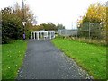
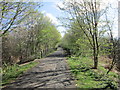
Footbridge over the A1
Here, Hadrian's Way, a path from Wylam to Newcastle along the north bank of the Tyne which carries both Hadrian's Cycleway
http://www.cycle-routes.org/HADRIANSCYCLEWAY/and Hadrian's Wall National Trail http://www.nationaltrail.co.uk/hadrianswall/ crosses the A1 (Newcastle By-pass). The fencing is to deter anyone with the idea of getting down onto the main road from this point.
Image: © Oliver Dixon
Taken: 8 Nov 2008
0.16 miles
9
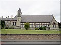
Church of St George, Lemington
A Roman Catholic church by A.M. Dunn dating from 1868, built at the expense of Richard Lamb of West Denton. There is an attached Presbytery (left), and school (behind). This church and Image stand on opposite sides of the narrow, heavily wooded Sugley Dene http://newcastlephotos.blogspot.com/2007/06/sugley-dene.html
Image: © Andrew Curtis
Taken: 28 Jul 2010
0.19 miles