IMAGES TAKEN NEAR TO
Norton Way, NEWCASTLE UPON TYNE, NE15 7QU
Introduction
This page details the photographs taken nearby to Norton Way, NE15 7QU by members of the Geograph project.
The Geograph project started in 2005 with the aim of publishing, organising and preserving representative images for every square kilometre of Great Britain, Ireland and the Isle of Man.

There are currently over 7.5m images from over14,400 individuals and you can help contribute to the project by visiting https://www.geograph.org.uk
Image Map (11 Images)


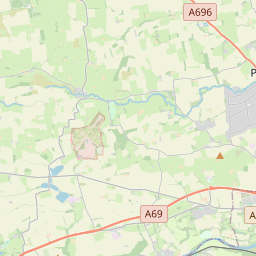


Leaflet Map data © OpenStreetMap
Images are licensed for reuse under creativecommons.org/licenses/by-sa/2.0
Notes
- Clicking on the map will re-center to the selected point.
- The higher the marker number, the further away the image location is from the centre of the postcode.
Image Listing (11 Images Found)
Images are licensed for reuse under creativecommons.org/licenses/by-sa/2.0
Image
Details
Distance
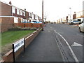
3
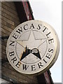
Newcastle Breweries sign on The Vallum, Moorcroft Road
See Image For a (slightly out of date) history of breweries in Newcastle, see http://www.cannybevvy.co.uk/Breweries/Ex_Breweries/Brewery_History/brewery_history.html; and http://www.breweryhistory.com/Breweries/TyneNewcastleBrewery.htm.
Image: © Mike Quinn
Taken: 23 Feb 2010
0.11 miles

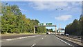
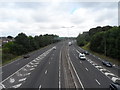
7
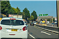
Blaydon : A1
Looking north along the A1.
Image: © Lewis Clarke
Taken: 21 Sep 2020
0.23 miles