
IMAGES TAKEN NEAR TO
Featherwood Avenue, NEWCASTLE UPON TYNE, NE15 6AZ
Introduction
This page details the photographs taken nearby to Featherwood Avenue, NE15 6AZ by members of the Geograph project.
The Geograph project started in 2005 with the aim of publishing, organising and preserving representative images for every square kilometre of Great Britain, Ireland and the Isle of Man.

There are currently over 7.5m images from over14,400 individuals and you can help contribute to the project by visiting https://www.geograph.org.uk
Image Map
Images are licensed for reuse under creativecommons.org/licenses/by-sa/2.0
Notes
- Clicking on the map will re-center to the selected point.
- The higher the marker number, the further away the image location is from the centre of the postcode.
Image Listing (17 Images Found)
Images are licensed for reuse under creativecommons.org/licenses/by-sa/2.0
Image
Details
Distance
1
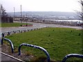
Armstrong Road from Wayside, Benwell
Looking down on the development site of Scotswood and Delaval, recently cleared and levelled before new house building starts.
Image: © Andrew Curtis
Taken: 23 Mar 2012
0.05 miles
2
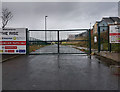
Whitehouse Road
Whitehouse Road in Scotswood.
Image: © Peter McDermott
Taken: 31 Mar 2019
0.11 miles
3
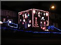
Christmas lights, Wayside, Benwell
The decorations on this and the almost neighbouring houses of Haig Crescent Image, Image remind me of the 2004 television drama, 'Christmas Lights' where suburban neighbours Colin (played by Robson Green) and Howard (Mark Benton) try to out-compete each other in their light displays https://en.wikipedia.org/wiki/Christmas_Lights_%28film%29
Image: © Andrew Curtis
Taken: 16 Dec 2015
0.16 miles
4
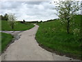
Hadrian's Wall Path nearing Scotswood
Image: © David Purchase
Taken: 24 May 2013
0.17 miles
5
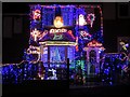
Christmas lights, Haig Crescent, Benwell
See description here Image
Image: © Andrew Curtis
Taken: 16 Dec 2015
0.18 miles
6
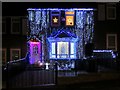
Christmas lights, Haig Crescent, Benwell
See description here Image
Image: © Andrew Curtis
Taken: 16 Dec 2015
0.18 miles
8
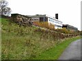
Whitehouse Enterprise Centre
A major redevelopment of old industrial premises overlooking the Tyne in eastern Newcastle. Seen from Hadrian's Way which carries both Hadrian's Cycleway http://www.cycle-routes.org/HADRIANSCYCLEWAY/and Hadrian's Wall NationalTrail http://www.nationaltrail.co.uk/hadrianswall/.
Image: © Oliver Dixon
Taken: 8 Nov 2008
0.19 miles
9
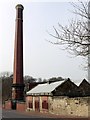
Benwell Water Pumping Station, Axwell Park Road
The pumping engine chimney was built in 1904 for the Newcastle and Gateshead Water Co. https://historicengland.org.uk/listing/the-list/list-entry/1186128
To the right of the chimney is the former lodge house built around 1857 for the Whittle Dean Water Company https://historicengland.org.uk/listing/the-list/list-entry/1024949
Although the lodge and chimney are no longer in use, the water pumping station was recently upgraded, providing a supply of drinking water to a large area of Newcastle's west end, via a large underground reservoirs behind. The earlier open reservoirs situated on the east side have been filled in and grassed over.
Image: © Andrew Curtis
Taken: 23 Mar 2012
0.20 miles
10
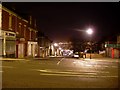
Delaval Road
In Benwell, west of Newcastle. At the bottom of the hill, the Gateshead MetroCentre - the largest shopping centre in the EU - can be seen.
Image: © Stephen Sweeney
Taken: 12 Jan 2009
0.20 miles