IMAGES TAKEN NEAR TO
Birks Road, NEWCASTLE UPON TYNE, NE15 0HF
Introduction
This page details the photographs taken nearby to Birks Road, NE15 0HF by members of the Geograph project.
The Geograph project started in 2005 with the aim of publishing, organising and preserving representative images for every square kilometre of Great Britain, Ireland and the Isle of Man.

There are currently over 7.5m images from over14,400 individuals and you can help contribute to the project by visiting https://www.geograph.org.uk
Image Map
Images are licensed for reuse under creativecommons.org/licenses/by-sa/2.0
Notes
- Clicking on the map will re-center to the selected point.
- The higher the marker number, the further away the image location is from the centre of the postcode.
Image Listing (28 Images Found)
Images are licensed for reuse under creativecommons.org/licenses/by-sa/2.0
Image
Details
Distance
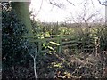
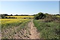
1
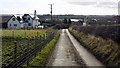
Road between Heddon Birks and Holmside
Image: © Andrew Curtis
Taken: 22 Feb 2009
0.03 miles
2
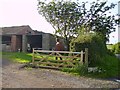
Guarding the gates
Statue at Heddon View farm. One of 2 that are guarding the entrance to the farm buildings.
Image: © Newbiggin Hall Scouts
Taken: 22 Jul 2007
0.07 miles
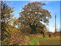
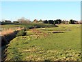
7
Pasture south of Heddon Birks
View towards Heddon on the Wall
Image: © Andrew Curtis
Taken: 22 Feb 2009
0.14 miles
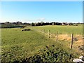
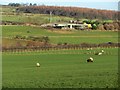
9
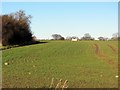
Arable field south of West Woodside Farm
Image: © Andrew Curtis
Taken: 26 Dec 2013
0.15 miles