IMAGES TAKEN NEAR TO
Stonecroft, NEWCASTLE UPON TYNE, NE15 0AF
Introduction
This page details the photographs taken nearby to Stonecroft, NE15 0AF by members of the Geograph project.
The Geograph project started in 2005 with the aim of publishing, organising and preserving representative images for every square kilometre of Great Britain, Ireland and the Isle of Man.

There are currently over 7.5m images from over14,400 individuals and you can help contribute to the project by visiting https://www.geograph.org.uk
Image Map
Images are licensed for reuse under creativecommons.org/licenses/by-sa/2.0
Notes
- Clicking on the map will re-center to the selected point.
- The higher the marker number, the further away the image location is from the centre of the postcode.
Image Listing (80 Images Found)
Images are licensed for reuse under creativecommons.org/licenses/by-sa/2.0
Image
Details
Distance
1

North Farm, Horsley
No longer a working farm, the old farmhouse is one of the oldest buildings in Horsley. It is built in the Jacobean style popular in the late 17th and early 18th centuries.
Image: © Andrew Curtis
Taken: 16 Jan 2009
0.02 miles
2
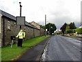
Scarecrow 'speed-trap', Horsley
Situated below the usual radar speed display as an attempt to reduce traffic speed through the village.
Image: © Andrew Curtis
Taken: 19 Jul 2015
0.03 miles
4
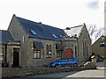
The (former) Wesleyan Methodist Church
Now a private dwelling.
Image: © Mike Quinn
Taken: 26 Mar 2018
0.05 miles
5
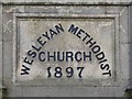
Date stone on the (former) Wesleyan Methodist Church
See Image
Image: © Mike Quinn
Taken: 26 Mar 2018
0.05 miles

8

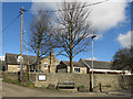
Set aside at Horsley
Colourful weeds growing on a field of 'set aside' a north of the village.
Image: © Helen Wilkinson
Taken: 17 Jul 2007
0.06 miles
9
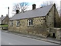
The Old Smithy, Horsley
The north side of the main street to the west of the old cross roads starts with a peculiarity. The cottage, marked as a smithy on the 1895 Ordnance Survey, has the look of an C18th building with its triangular-shaped stone gable copings, but does not appear on the 1865 map. The small spring issuing through into the boundary wall is a rare historic street detail.
Horsley Conservation Area Character Appraisal, Tynedale Council (2009).
Image: © Andrew Curtis
Taken: 28 Mar 2013
0.07 miles