
IMAGES TAKEN NEAR TO
Gallowgate, NEWCASTLE UPON TYNE, NE1 4SR
Introduction
This page details the photographs taken nearby to Gallowgate, NE1 4SR by members of the Geograph project.
The Geograph project started in 2005 with the aim of publishing, organising and preserving representative images for every square kilometre of Great Britain, Ireland and the Isle of Man.

There are currently over 7.5m images from over14,400 individuals and you can help contribute to the project by visiting https://www.geograph.org.uk
Image Map
Images are licensed for reuse under creativecommons.org/licenses/by-sa/2.0
Notes
- Clicking on the map will re-center to the selected point.
- The higher the marker number, the further away the image location is from the centre of the postcode.
Image Listing (1199 Images Found)
Images are licensed for reuse under creativecommons.org/licenses/by-sa/2.0
Image
Details
Distance
1
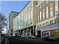
Gallowgate
From right to left: Magnet Court Image, Time Central (2004-2007) and Wellbar House (2009) Image on the north side of Gallowgate.
Image: © Andrew Curtis
Taken: 28 Oct 2010
0.00 miles
2
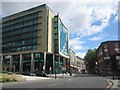
Looking east along Gallowgate
Looking east along Gallowgate. The new Wellbar Central office building is on the left.
Image: © Graham Robson
Taken: 30 Jul 2012
0.02 miles
3
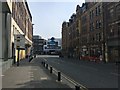
Gallowgate
This is one of the usually busier streets in Newcastle city centre, but is void of people and traffic owing to the COVID-19 'lockdown' measures implemented by the UK Government
Image: © Anthony Foster
Taken: 10 Apr 2020
0.02 miles
4
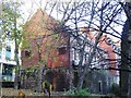
St. Andrew's churchyard and part of the Town Wall
A close-up of the wall is shown in Image This section of wall is Grade I listed http://list.historicengland.org.uk/resultsingle.aspx?uid=1355241 .
Image: © Mike Quinn
Taken: 19 Nov 2013
0.02 miles
5
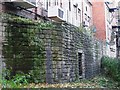
Town Wall, St. Andrew's churchyard, NE1 (2)
See Image St. Andrew's Tower used to stand in the churchyard between these two remaining sections of wall. See also Image and Image This section of wall is Grade I listed http://list.historicengland.org.uk/resultsingle.aspx?uid=1355241 .
Image: © Mike Quinn
Taken: 19 Nov 2013
0.02 miles
6

Magnet House and Andrews House, Gallowgate, NE1
See also Image
Image: © Mike Quinn
Taken: 14 Jul 2026
0.02 miles
7

Magnet and Andrews Houses, Gallowgate
Detail and description of this 1930s office block is here Image
Image: © Andrew Curtis
Taken: 31 Jan 2010
0.03 miles
8
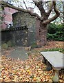
Town Walls at St Andrew's
A short surviving section of the town wall at Newcastle. In St Andrew's churchyard. The wall was constructed in the 13th and 14th centuries and much of it was demolished in the early 19th century.
Image: © Robert Graham
Taken: 14 Nov 2022
0.03 miles
9
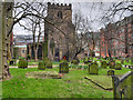
The Parish Church of St Andrew
The Church of Saint Andrew in Newgate Street is a grade I listed building (English Heritage List Entry Number: 1104887 http://www.heritagegateway.org.uk/Gateway/Results_Single.aspx?uid=1104887&resourceID=5 Heritage Gateway). The chancel arch and lower part of tower and arcades date from the twelfth century but the church is mainly of thirteenth and fourteenth century construction. The porch was re-fronted in 1726. Other restoration work was undertaken in 1866.
http://www.standrewsnewcastle.org.uk/ church website
Image: © David Dixon
Taken: 23 Mar 2016
0.03 miles
10

New office building, at the junction of Gallowgate and St Andrew's Street
Image: © Christine Johnstone
Taken: 4 Mar 2010
0.03 miles