
IMAGES TAKEN NEAR TO
Hanover Street, NEWCASTLE UPON TYNE, NE1 3AB
Introduction
This page details the photographs taken nearby to Hanover Street, NE1 3AB by members of the Geograph project.
The Geograph project started in 2005 with the aim of publishing, organising and preserving representative images for every square kilometre of Great Britain, Ireland and the Isle of Man.

There are currently over 7.5m images from over14,400 individuals and you can help contribute to the project by visiting https://www.geograph.org.uk
Image Map
Images are licensed for reuse under creativecommons.org/licenses/by-sa/2.0
Notes
- Clicking on the map will re-center to the selected point.
- The higher the marker number, the further away the image location is from the centre of the postcode.
Image Listing (1532 Images Found)
Images are licensed for reuse under creativecommons.org/licenses/by-sa/2.0
Image
Details
Distance
1

(Former) bonded warehouses, Hanover Street, NE1 (2)
See Image
Image: © Mike Quinn
Taken: 10 Mar 2015
0.00 miles
2

Date stone on the (former) bonded warehouses, Hanover Street, NE1
See Image
Image: © Mike Quinn
Taken: 10 Mar 2015
0.01 miles
3

(Former) bonded warehouses, Hanover Street, NE1
The buildings, now flats, are Grade II listed http://list.historicengland.org.uk/resultsingle.aspx?uid=1355271 .
Although only two and three storeys high at their rear, here on Hanover Street, the buildings are seven storeys high at their front on Close - see Image
Image: © Mike Quinn
Taken: 10 Mar 2015
0.01 miles
4
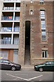
Stairs between The Close and Hanover Street
Stairs between The Close and Hanover Street, Spoors Warehouse, circa 1841-1844.
Image: © Charlie Bell
Taken: 19 Jun 2008
0.01 miles
5
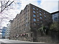
(Former) bonded warehouses, Close, NE1
The buildings are only two and three storeys high at their rear on Hanover Street - see Image
Image: © Mike Quinn
Taken: 10 Mar 2015
0.01 miles
6
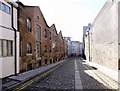
Hanover Street
The street and the former bonded warehouses on the left, which front on The Close Image, were built for Amor Spoor in 1841-44 Image Three serious fires here destroyed much of the original Image but luckily part of the exterior was still available to be incorporated along with the neighbouring new-build as apartments in 2008 Image
Hanover Street rises gently west to east behind the original warehouses. The two lines of Shap granite blocks on the right hand side provided a smooth surface for carts, while the horses pulling them would get a good grip on the cobbles between Image
Image: © Andrew Curtis
Taken: 2 Mar 2010
0.01 miles
7

Hoist on the (former) bonded warehouses, Hanover Street, NE1
See Image
Image: © Mike Quinn
Taken: 10 Mar 2015
0.01 miles
8

Hanover Street, Newcastle upon Tyne
The two lines of Shap granite blocks on the right hand side of the street that rises steeply from Close provided a smooth surface for carts, while the horses pulling them would get a good grip on the cobbles between. This system was only provided for uphill traffic. The idea is thought to have been used first in northern Italy and introduced in the early nineteenth century.
There is another photo here Image
Image: © Andrew Curtis
Taken: 2 Sep 2015
0.01 miles
9

(Part of) the Queen Elizabeth II Metro Bridge
Image: © Mike Quinn
Taken: 10 Feb 2015
0.01 miles
10

(Former) bonded warehouses, Close, NE1 (2)
See Image
Image: © Mike Quinn
Taken: 10 Mar 2015
0.01 miles