IMAGES TAKEN NEAR TO
Dahlia Grove, NE13 9FJ
Introduction
This page details the photographs taken nearby to Dahlia Grove, NE13 9FJ by members of the Geograph project.
The Geograph project started in 2005 with the aim of publishing, organising and preserving representative images for every square kilometre of Great Britain, Ireland and the Isle of Man.

There are currently over 7.5m images from over14,400 individuals and you can help contribute to the project by visiting https://www.geograph.org.uk
Image Map
Images are licensed for reuse under creativecommons.org/licenses/by-sa/2.0
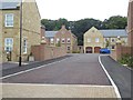
Notes
- Clicking on the map will re-center to the selected point.
- The higher the marker number, the further away the image location is from the centre of the postcode.
Image Listing (18 Images Found)
Images are licensed for reuse under creativecommons.org/licenses/by-sa/2.0
Image
Details
Distance
1
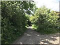
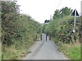
Public Footpath
Footpath and traffic free cycle route
Image: © peter maddison
Taken: 12 Jan 2011
0.11 miles
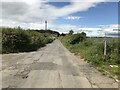
4
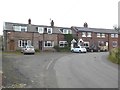
West Brunton Farm Cottages
The original farm cottages still stand, but the farmhouse has given way to an exclusive new housing complex.
Image: © Oliver Dixon
Taken: 2 Sep 2019
0.19 miles
5
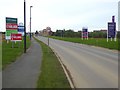
Keen competition on Wagonway Drive
Billboards of several different developers at the way in to the southern part of the Great Park development.
Image: © Oliver Dixon
Taken: 2 Sep 2019
0.19 miles
6
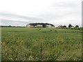
Arable field at West Brunton farm
A field of wheat with visible ears of grain close to West Brunton farm.
Image: © Graham Robson
Taken: 10 Jul 2016
0.19 miles
7
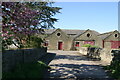
West Brunton Farm outbuildings
Viewed in 2007, these buildings were demolished to build the Brunton Square development. The date stone (1884) was recovered and has been built into the wall at the junction of the cul-de-sac and Brunton Lane.
Image: © Phil Thirkell
Taken: 30 Apr 2007
0.20 miles
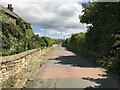
8
New housing at West Brunton Farm
A new cul-de-sac of up-market houses has been built on the site of West Brunton Farm.
Image: © Oliver Dixon
Taken: 2 Sep 2019
0.21 miles
9
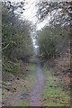
Brunton Lane
At one time, Brunton Lane provided a through road for motor vehicles from West Brunton Farm and points west right through to the Great North Road. However, recent development has led to the downgrading of the Lane to a cycle- and footpath from West Brunton Farm most of the way through the Great Park development. At its eastern end, Brunton Lane is a bus-only road bridging the A1 Newcastle Western By-pass. As a result of these changes, there is now no exit westwards for motor vehicles from any part of Great Park, whilst to the east all traffic (except buses) has to pass through the Great Parkway roundabout at the A1. On the bright side, Brunton Lane affords a perfect opportunity for cyclists to get out into the surrounding countryside in traffic-free conditions.
Image: © Oliver Dixon
Taken: 2 Sep 2019
0.22 miles