
IMAGES TAKEN NEAR TO
Widdrington Gardens, NEWCASTLE UPON TYNE, NE13 6JF
Introduction
This page details the photographs taken nearby to Widdrington Gardens, NE13 6JF by members of the Geograph project.
The Geograph project started in 2005 with the aim of publishing, organising and preserving representative images for every square kilometre of Great Britain, Ireland and the Isle of Man.

There are currently over 7.5m images from over14,400 individuals and you can help contribute to the project by visiting https://www.geograph.org.uk
Image Map
Images are licensed for reuse under creativecommons.org/licenses/by-sa/2.0
Notes
- Clicking on the map will re-center to the selected point.
- The higher the marker number, the further away the image location is from the centre of the postcode.
Image Listing (10 Images Found)
Images are licensed for reuse under creativecommons.org/licenses/by-sa/2.0
Image
Details
Distance
1
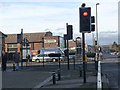
Traffic lights at the centre of Wideopen
Stalks Road comes in from the left to join North Road (formerly the A1, the Great North Road, now the B1318) in the centre of Wideopen. The Co-op, the largest shop in the village lies just beyond the traffic lights.
Image: © Oliver Dixon
Taken: 23 Feb 2012
0.04 miles
2
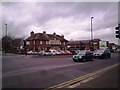
The Travellers Rest, Wide Open
A well known landmark pub on the road north from Newcastle. This was once the A1, The Great North Road, before the building of the motorway a short distance to the west.
Image: © Robert Graham
Taken: 28 Nov 2011
0.04 miles
3
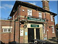
Travellers Rest Public House, Wideopen
When the first Ordnance Survey Six-Inch map of the area was published in 1864 there was a Travellers Rest (PH) located on this site although this building appears to be from a much later date. Standing alongside the old Great North Road, this site will have served passing travellers for many many years.
Image: © Geoff Holland
Taken: 10 Nov 2020
0.05 miles
5
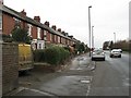
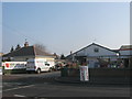
Terrace, Wideopen
Terraced houses along what was once the A1. There are football pitches on the opposite side of the road.
Image: © Richard Webb
Taken: 7 Mar 2009
0.13 miles
6
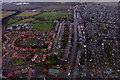
Wideopen
Wideopen, seen from the air.
Image: © Peter McDermott
Taken: 13 Nov 2008
0.17 miles
7
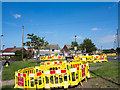
Excavations on Stalks Road
Northern Gas is responsible for these excavations on Stalks Road, Wideopen; there are signs apologising for any convenience.
Image: © Trevor Littlewood
Taken: 30 Jun 2015
0.19 miles
8
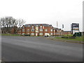
New Housing development, Wideopen
Looking across the B1318 towards the new housing development of Five Mile Park.
Image: © Graham Robson
Taken: 22 Jan 2017
0.19 miles
9
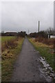
Disused Wagon way
Mineral line once known as the Fawdon old Wagon way which was used to transport Coal from the Havannah drift colliery on the outskirts of the villages of Brunswick and Dinnington next to Havannah farm the colliery opened in 1950 and it Was connected to the Seaton burn wagon way using part of the original line west of Seaton burn however in the 1970s some land above the workings was chosen to expand Newcastle airport continued miming could have caused subsidence of the new runway So the colliery closed in 1977 the wagon way date back to the 17th Century and were built to transport coal from the collieries down to the north bank of the Tyne.
Image: © peter maddison
Taken: 12 Jan 2011
0.23 miles
10
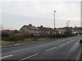
The B1318, Wideopen
Looking south along the B1318 through Wideopen.
Image: © Graham Robson
Taken: 22 Jan 2017
0.24 miles